Fact Sheet 2008–3096
ABSTRACT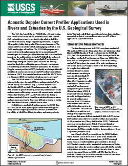
The U.S. Geological Survey (USGS) has collected streamflow information for the Nation's streams since 1889. Streamflow information is used to predict floods, manage and allocate water resources, design engineering structures, compute water-quality loads, and operate water-control structures. The current (2007) size of the USGS streamgaging network is over 7,400 streamgages nationwide. The USGS has progressively improved the streamgaging program by incorporating new technologies and techniques that streamline data collection while increasing the quality of the streamflow data that are collected. The single greatest change in streamflow measurement technology during the last 100 years has been the development and application of high frequency acoustic instruments for measuring streamflow. One such instrument, the acoustic Doppler current profiler (ADCP), is rapidly replacing traditional mechanical current meters for streamflow measurement (Muste and others, 2007). For more information on how an ADCP works see Simpson (2001) or visit http://hydroacoustics.usgs.gov/. The USGS has used ADCPs attached to manned or tethered boats since the mid-1990s to measure streamflow in a wide variety of conditions (fig. 1). Recent analyses have shown that ADCP streamflow measurements can be made with similar or greater accuracy, efficiency, and resolution than measurements made using conventional current-meter methods (Oberg and Mueller, 2007). ADCPs also have the ability to measure streamflow in streams where traditional current-meter measurements previously were very difficult or costly to obtain, such as streams affected by backwater or tides. In addition to streamflow measurements, the USGS also uses ADCPs for other hydrologic measurements and applications, such as computing continuous records of streamflow for tidally or backwater affected streams, measuring velocity fields with high spatial and temporal resolution, and estimating suspended-sediment concentrations. An overview of these applications is provided in the fact sheet. |
First posted March 24, 2009 For additional information contact: Part or all of this report is presented in Portable Document Format (PDF); the latest version of Adobe Reader or similar software is required to view it. Download the latest version of Adobe Reader, free of charge. |
Gotvald, A.J., and Oberg, K,A., 2008,, Acoustic Doppler current profiler applications used in rivers and estuaries by the U.S. Geological Survey: U.S. Geological Survey Fact Sheet 2008–3096, 4 p.
Streamflow Measurements
Index-Velocity Method
Measuring Velocity Fields
Estimating Suspended Sediment
Summary
References Cited

![]() U.S. Department of the Interior |
U.S. Geological Survey
U.S. Department of the Interior |
U.S. Geological Survey
URL: http://
pubsdata.usgs.gov
/pubs/fs/2008/3096/index.html
Page Contact Information: USGS Publications Team
Page Last Modified: Tuesday, 29-Nov-2016 18:23:31 EST
