Fact Sheet 2009–3065
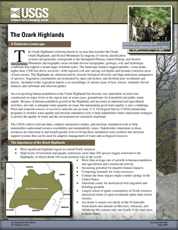
The Ozark Highlands include diverse topographic, geologic, soil, and hydrologic conditions that support a broad range of habitat types. The landscape features rugged uplands—some peaks higher than 2,500 feet above sea level—with exposed rock and varying soil depths and includes extensive areas of karst terrain. The Highlands are characterized by extreme biological diversity and high endemism (uniqueness of species). Vegetation communities are dominated by open oak-hickory and shortleaf pine woodlands and forests. Included in this vegetation matrix is an assemblage of various types of fens, forests, wetlands, fluvial features, and carbonate and siliceous glades. An ever-growing human population in the Ozark Highlands has become very dependent on reservoirs constructed on major rivers in the region and, in some cases, groundwater for household and public water supply. Because of human population growth in the Highlands and increases in industrial and agricultural activities, not only is adequate water quantity an issue, but maintaining good water quality is also a challenge. Point and nonpoint sources of excessive nutrients are an issue. U.S. Geological Survey (USGS) partnership programs to monitor water quality and develop simulation tools to help stakeholders better understand strategies to protect the quality of water and the environment are extremely important. The USGS collects relevant data, conducts interpretive studies, and develops simulation tools to help stakeholders understand resource availability and sustainability issues. Stakeholders dependent on these resources are interested in and benefit greatly from evolving these simulation tools (models) into decision support systems that can be used for adaptive management of water and ecological resources. The interaction of unique and high-quality biological and hydrologic resources and the effects of stresses from human activities can be evaluated best by using a multidisciplinary approach that the USGS can provide. Information varying from defining baseline resource conditions to developing simulation models will help resource managers and users understand the human impact on resource sustainability. Varied expertise and experience in biological and water-resources activities across the entire Highlands make the USGS a valued collaborator in studies of Ozark ecosystems, streams, reservoirs, and groundwater. A large part of future success will depend on the involvement and active participation of key partners. |
First posted September 15, 2009 For additional information contact: Part or all of this report is presented in Portable Document Format (PDF); the latest version of Adobe Reader or similar software is required to view it. Download the latest version of Adobe Reader, free of charge. |
Ethridge, M., 2009, The Ozark Highlands: U.S. Geological Survey Fact Sheet 2009-3065, 2 p.

![]() U.S. Department of the Interior |
U.S. Geological Survey
U.S. Department of the Interior |
U.S. Geological Survey
URL: http://pubsdata.usgs.gov/pubs/fs/2009/3065/index.html
Page Contact Information: GS Pubs Web Contact
Page Last Modified: Tuesday, 29-Nov-2016 17:34:59 EST
