Summary
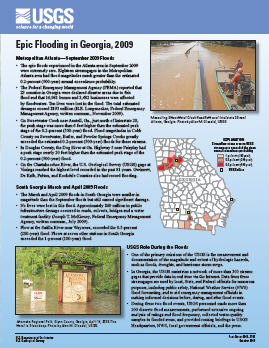
Metropolitan Atlanta—September 2009 Floods
- The epic floods experienced in the Atlanta area in September 2009
were extremely rare. Eighteen streamgages in the Metropolitan
Atlanta area had flood magnitudes much greater than the estimated 0.2-percent (500-year) annual exceedance probability.
- The Federal Emergency Management Agency (FEMA) reported that
23 counties in Georgia were declared disaster areas due to this flood and that 16,981 homes and 3,482 businesses were affected by floodwaters. Ten lives were lost in the flood. The total estimated damages exceed $193 million (H.E. Longenecker, Federal Emergency Management Agency, written commun., November 2009).
- On Sweetwater Creek near Austell, Ga., just north of Interstate 20,
the peak stage was more than 6 feet higher than the estimated peak stage of the 0.2-percent (500-year) flood. Flood magnitudes in Cobb
County on Sweetwater, Butler, and Powder Springs Creeks greatly
exceeded the estimated 0.2-percent (500-year) floods for these streams.
- In Douglas County, the Dog River at Ga. Highway 5 near Fairplay had
a peak stage nearly 20 feet higher than the estimated peak stage of the 0.2-percent (500-year) flood.
- On the Chattahoochee River, the U.S. Geological Survey (USGS) gage at
Vinings reached the highest level recorded in the past 81 years. Gwinnett, De Kalb, Fulton, and Rockdale Counties also had record flooding.
South Georgia March and April 2009 Floods
The March and April 2009 floods in South Georgia were smaller in
magnitude than the September floods but still caused significant damage.
No lives were lost in this flood. Approximately $60 million in public
infrastructure
damage occurred to roads, culverts, bridges and a water
treatment facility (Joseph T. McKinney, Federal Emergency Management Agency, written commun., July 2009).
Flow at the Satilla River near Waycross, exceeded the 0.5-percent
(200-year) flood. Flows at seven other stations in South Georgia
exceeded the 1-percent (100-year) flood.
|
First posted October 20, 2010
Part or all of this report is presented in Portable Document Format (PDF); the latest version of Adobe Reader or similar software is required to view it. Download the latest version of Adobe Reader, free of charge. |

