 Abstract Abstract
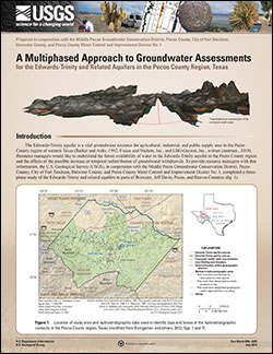
The Edwards-Trinity aquifer is a vital groundwater resource for agricultural, industrial, and public supply uses in the Pecos County region of western Texas. Resource managers would like to understand the future availability of water in the Edwards-Trinity aquifer in the Pecos County region and the effects of the possible increase or temporal redistribution of groundwater withdrawals. To provide resource managers with that information, the U.S. Geological Survey (USGS), in cooperation with the Middle Pecos Groundwater Conservation District, Pecos County, City of Fort Stockton, Brewster County, and Pecos County Water Control and Improvement District No. 1, completed a three-phase study of the Edwards-Trinity and related aquifers in parts of Brewster, Jeff Davis, Pecos, and Reeves Counties. The first phase was to collect groundwater, surface-water, geochemical, geophysical, and geologic data in the study area and develop a geodatabase of historical and collected data. Data compiled in the first phase of the study were used to develop the conceptual model in the second phase of the study. The third phase of the study involved the development and calibration of a numerical groundwater-flow model of the Edwards-Trinity aquifer to simulate groundwater conditions based on various groundwater-withdrawal scenarios.
Analysis of well, geophysical, geochemical, and hydrologic data contributed to the development of the conceptual model in phase 1. Lithologic information obtained from well reports and geophysical data was used to describe the hydrostratigraphy and structural features of the groundwater-flow system, and aquifer-test data were used to estimate aquifer hydraulic properties. Geochemical data were used to evaluate groundwater-flow paths, water-rock interaction, aquifer interaction, and the mixing of water from different sources in phase 2. Groundwater-level data also were used to evaluate aquifer interaction, as well as to develop a potentiometric-surface map, delineate regional groundwater divides, and describe regional groundwater-flow paths. During phase 3, the data collected and compiled along with the conceptual information in the study area were incorporated into a numerical groundwater-flow model to evaluate the sustainability of recent (2008) and projected water-use demands on groundwater resources in the study area.
|
First posted August 5, 2014
Part or all of this report is presented in Portable Document Format (PDF). For best results viewing and printing PDF documents, it is recommended that you download the documents to your computer and open them with Adobe Reader. PDF documents opened from your browser may not display or print as intended. Download the latest version of Adobe Reader, free of charge. More information about viewing, downloading, and printing report files can be found here.
|

