|
|
The U.S. Geological Survey (USGS), which has offices in every State and
Commonwealth, collects, compiles, and disseminates data on natural hazards
and water, energy, biological, and mineral resources in the State of
Kentucky. The long-term earth science information base of the USGS is a
valued resource for the public and private sectors, academia, State and
local agencies, and other Federal agencies. This Fact Sheet describes some
of the USGS activities in Kentucky. |

|
|
The USGS's National Water-Quality Assessment (NAWQA) Program was
established to describe the status and trends in the quality of a large,
representative part of the Nation's surface- and ground-water resources and
to identify the natural and human factors that affect their quality. The
NAWQA Program provides vital physical, chemical, and biological
water-quality data to State and local officials charged with water-use
planning and water-quality management. |
From 1987 through 1990, the USGS collected water-quality data in the
Kentucky River Basin as a part of the pilot NAWQA Program. The
7,000-square-mile Kentucky River Basin is the most densely populated major
river basin in the State. The Kentucky River and its tributaries are used
extensively for municipal and industrial water supply, recreation, and
wastewater discharge and assimilation. The River provides more than 95
percent of the drinking-water supply to the 600,000 people in the Basin.
Some components of water quality examined were the distribution of metals
and other trace elements in the sediment and water; nutrients, sediments,
and pesticides also were studied in the streams of the Basin. |
|
|
|
Urbanization in Jefferson County is continuing at a steady rate. As land
within a watershed is developed, there is, in general, a decrease in the
amount of area for infiltration of rainfall. This results in high peak
streamflows that occur more often than they might have previously (fig.
1). There also is generally an increase in the types and amounts of
pollutants being transported to the streams.
(Click on image for a larger version, 152K GIF)
|
|
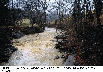
Figure 1. Water level 2 feet below peak during high-flow
inspection at Boone Creek, Kentucky |
The Louisville and Jefferson County Metropolitan Sewer District (MSD) is
the lead agency responsible for managing surface-water resources in
Jefferson County. These responsibilities include stormwater management and
flood control; wastewater collection, treatment, and disposal; industrial
waste pretreatment; and other related activities. The MSD's mission is to
preserve, protect, and improve water quality in Jefferson County streams.
|
The objectives of the joint program between the USGS and the MSD are to
characterize the hydrology and water-quality conditions of streams in
Jefferson County and to develop tools to use as aids in formulating
strategies for the wise management of the water resources of these streams.
A watershed-management approach is being adopted as the method
to evaluate the effects of land use on stream hydrology and water quality
within selected basins.
The most appropriate tool for use in the watershed approach is a
continuous-based hydrologic/water-quality model. Such a model has been
developed for the Beargrass Creek watershed, and one is being developed for
the Chenoweth Run watershed. Eventually, other watersheds also would be
modeled. These models allow the MSD to evaluate the effects that land-use
changes, such as residential or industrial development, within each
watershed, will have on the receiving streams.
The joint USGS/MSD program has focused primarily on the collection of
baseline information to make gross assessments of water-quality conditions
and the spatial variability of rainfall. Some baseline precipitation and
water-quality data on streams throughout the County will continue to be
collected. A project is underway to evaluate the current water-quality
monitoring network and to decide whether a sampling location can be
eliminated, visited less frequently, or remain in its current status. Part
of this assessment is to evaluate the need for more storm sampling at the
water-quality monitoring locations to characterize a variety of storm types
and to define seasonal changes in water quality during storm-runoff
periods. |
|
|
|
Many State and local agencies in Kentucky need streamflow data and related
information. For example, bridge and highway engineers need streamflow
information to design bridges and culverts; water-treatment planners and
managers need streamflow information to determine a stream's capacity to
carry effluent; and water-supply planners and managers need this type of
information to monitor current conditions and to estimate available supply
for formulating plans for population increase and economic development.
Information collected at selected streamflow-gaging stations is used to
monitor current conditions, such as droughts, and the information collected
at these stations may be site specific (fig. 2). Some stations have been
established primarily for regional analysis of streamflow data. The data
and information collected at these stations also are site specific but are
considered to be transferable and can, therefore, be used to develop
regional equations to estimate selected streamflow characteristics at
stream sites where little or no information is available. Typically,
equations are developed to estimate stream-flow characteristics such as the
100-year peak discharge, which is used in the design of bridges and
culverts and to delineate floodplain boundaries. Regional equations may
also be developed to estimate selected low-flow characteristics such as the
7-day, 10-year low-flow discharge, which is used for water-quantity and
water-quality permitting.

(Click on image for a larger version, 138K GIF)
|
|
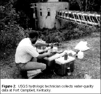
Figure 2. USGS hydrologic technician collects
water-quality data at Fort Campbell, Kentucky. | |
The Kentucky District recently analyzed the effectiveness of the
streamflow-gaging station network in Kentucky and nearby stations in
adjoining States. The results included a ranking of each station's
importance to how much the information at each station reduced the error
associated with estimates of streamflow at ungaged sites.
The network analysis technique also considered the inclusion of
hypothetical (new) stations into the network. This allows the user to
evaluate various locations where new gages could be installed and what
types of basin characteristics would result in the greatest reduction of
error associated with redefining the estimates of flow at ungaged sites. |
|
Much of Kentucky lies in the Appalachian Basin, which is a mature oil- and
gas-bearing basin. The USGS, in cooperation with the Kentucky Geological
Survey (KGS), is examining subsurface geologic structure and stratigraphy
to determine the potential for oil and gas production. As part of this
effort, the USGS and the KGS have jointly acquired seismic-reflection data
for the geologic feature known as the Rome Trough. The USGS has prepared
detailed stratigraphic sections through ancient strata of the Trough.
These data are used for locating subsurface structures and features, such
as reservoirs and stratigraphic traps that may contain petroleum resources.
The seismic-reflection data also are helpful in locating buried faults that
may produce earthquakes in the future. |
|
The USGS is completing a prototype quantitative national assessment of
mineral resources for five commonly used metals-gold, silver, copper, lead,
and zinc. To carry out this assessment, a cooperative project with the KGS
has been initiated to collect the necessary data. This assessment will
enable the USGS to respond quickly to requests for information about these
mineral resources throughout the country from Congress, Federal and State
agencies, industry, and the public. The assessment provides general
mineral information to land-use planners who are concerned with
resource-management issues, lists significant known deposits, identifies
areas with mineral potential, and provides estimates of the quantity of
each metal likely to be present. In Kentucky, tracts are delineated that
have potential for containing different kinds of zinc and lead deposits.
The assessment will be useful as a basis for more detailed, regional
studies. |
|
|
|
Ground water in the Ohio River alluvial aquifer is an important natural
resource for numerous communities located within the Ohio River Valley.
Increased use of this resource has been cause for increased attention to
and awareness of proper ground-water-resource management policies and
procedures. Currently, the USGS is conducting a number of investigations
that address ground-water resources in the Carrollton area, ground-water
movement near the city of Owensboro, and ground-water quality in the
Louisville area.
Each of the USGS investigations is conducted in cooperation with a local
governmental body or utility. The USGS and the Carroll County Water-Supply
Planning Board are working together to provide a better understanding of
the hydrogeologic conditions and to develop a ground-water model that can
be used by managers to effectively and efficiently manage the area's
ground-water resources to support the unprecedented industrial growth.
The USGS, in cooperation with the Owensboro Municipal Utilities, has
completed a preliminary investigation of the hydrogeology of the alluvial
aquifer at Owensboro and has developed a ground-water model that can be
used by planners to simulate present conditions and the effects of
projected demands on the aquifer and to reconfigure wellhead-protection
areas as needed. |
The USGS, in cooperation with the city of Louisville and an advisory group,
the Louisville Aquifer Study Group, is working to design, install, sample,
and maintain a network of ground-water-quality monitoring wells. The data
collected from this investigation will provide an accurate assessment of
the area's ground-water quality.
The alluvial aquifers along the Ohio River are and will continue to be
important water resources. The USGS is working with local cooperators to
increase the knowledge and to develop the tools needed to plan for future
influences on these resources. Present investigations have been designed
to collect and manage the needed data and incorporate them into regionally
consistent tools that help water managers and environmental coordinators
meet their water-use and environmental planning goals. |
|
|
|
Among the most popular and versatile products of the USGS are its
topographic maps at the scale of 1:24,000 (1 inch on the map represents
2,000 feet on the ground). These maps depict basic natural and cultural
features of the landscape, such as lakes and streams, highways and
railroads, boundaries, and geographic names; contour lines are used to
depict the elevation and shape of terrain. Kentucky is covered by 779 maps
at this scale. These maps are useful for civil engineering, land-use
planning, natural-resource monitoring, and other technical applications and
have long been favorites with the general public for outdoor uses,
including hiking, camping, hunting, exploring, and fishing expeditions.
The USGS is working with the KGS to develop an efficient method for
preparing digital data from the USGS geologic map series of Kentucky. As a
prototype, selected 7.5minute geologic maps are being scanned to produce
digital raster data that can be stored on CD-ROM's and used in a geographic
information system (GIS) as a base for overlaying other digital data. The
KGS is evaluating the initial results to assess the feasibility of
digitizing the geologic maps statewide. All the 7.5-minute geologic maps
for Kentucky could be scanned and stored on about 17 CD-ROM's. |
The USGS is working with the Kentucky Geographic Information Advisory
Council to produce a series of maps and plots demonstrating the use of
currently available GIS technology with existing digital data, such as
digital elevation models (DEM's), digital raster graphics (DRG's), and
digital orthophotoquads (DOQ's). A DEM is an array of regularly spaced
elevation values registered to a map base. A DRG is a scanned image of a
USGS topographic map, and a DOQ is a digital image that combines the image
characteristics of an aerial photograph with the geometric qualities of a
map. These computerized products can be used interactively to revise
obsolete maps.
The USGS is aiding the Kentucky office of GIS in evaluating existing
digital information for use with the proposed State digital base map. The
base map is being designed to provide a foundation with known positional
accuracy that may be used to tie specific geographic data to by State and
local agencies. Digital highway information has been evaluated for use
with DOQ's and DRG's. |
|
|
|
The Earth Science Information Centers (ESIC's) provide information to the
public about USGS programs, products, and technological developments. The
ESIC in Lexington was established under a cooperative agreement between the
USGS and the KGS. As part of the national ESIC network, this Center
provides information on such earth science topics as cartography,
geography, digital data, remote sensing, geology, geophysics, geochemistry,
hydrology, geohydrology, aerial photography, and land use. It is supported
by the USGS with reference materials, technical assistance, training and
outreach activities, and access to USGS data bases. |
The statemap Component of the National Cooperative Geologic Mapping Program
is funded through a matching grant with the KGS. The purpose of the project
is to convert Kentucky 7.5-minute geologic quadrangle maps to digital
format. The 161 maps that comprise the Kentucky River Basin have been
selected to be the first maps converted. The digital geologic maps, as
well as other GIS data, are useful to assess surface and ground water,
mineral resources, and environmental geology in the Basin. |
|
|
|
The effects of acidic mine drainage in the Appalachian Region coal fields
in eastern Kentucky and adjacent States are well known and extensively
studied; however, the effects of mining-related disturbances on ground
water are not well known. Most households in rural Appalachia in Kentucky
obtain water from privately owned wells and springs. Much anecdotal
evidence is available to indicate that blasting, mining-related subsidence,
and acidic drainage can affect ground water, but these effects are
generally not well documented, and cause-and-effect relations between
mining-related disturbance and degradation of ground-water quality and
quantity are poorly understood.
In a recent study done by the USGS, in cooperation with the Office of
Surface Mining Reclamation and Enforcement, dye-tracer tests were used to
investigate the movement of ground water in coal-bearing rocks near an
abandoned underground coal mine near Fishtrap Lake in Pike County.
Nontoxic fluorescent dyes were injected into a well at the top of a ridge
several times between 1985 and 1992. The subsurface movement of the dyes
was monitored by using water samples collected from monitoring wells
drilled at different depths into the ridge top and adjacent valley walls. |
The results of the study confirmed that dye-laden ground water moved most
rapidly through interconnected fractures in bedrock and coal beds. The
direction and rate of movement of the dyes was highly variable and mostly
dependent on fluctuations in ground-water elevations that had been caused
by changes in hydrologic conditions. In one tracer test, dye moved from
the ridge top to the deepest wells at an estimated velocity of 36 feet per
day. However, rapid movement of dyes to downgradient wells did not seem to
result in quick or efficient flushing of the dye from the ground-water
system. Instead, residual dyes, which are present in less transmissive
fracture zones, were periodically flushed following recharge events and
intermittently detected in downgradient wells weeks and even months after
injection.
The results of these dye-tracer tests are important because they provide
direct evidence of the rapid movement of ground water through fractures in
ridge- and valley-wall settings typical of the Appalachian Region coal
fields and the effects of mining-related subsidence on ground-water flow
paths. The movement of dyes during the tracer tests provides a conceptual
model for the migration of mining-related contaminants in fractured and
layered coal-bearing rocks that can be tested and refined by future
ground-water-quality studies. |
|
|
|
The USGS, in cooperation with the Department for Environmental Protection
(DEP) of the Kentucky Natural Resources and Environmental Protection
Cabinet, is working to understand and characterize the environmental
conditions and water resources of an area that includes an industrial
complex near Calvert City, so that the risk to public health and the
environment can be assessed. The resultant data and study findings will
assist the DEP in deciding how to remediate or abate problems related to
past waste-disposal practices in the area and in facilitating cooperation
of the public, waste industry, and government to manage and plan for future
protection and reduction of risk to the environment.
To address problems of potential ground-water contamination from the
industrial complex, it was necessary to understand the geology and
hydrology of the aquifer in the area to predict how long it would take
contaminants to move from one place to another in the ground water and what
direction they would take. To understand the geohydrology, test wells were
drilled, ground-water levels were monitored, and streamflows in nearby
streams were measured. |
A ground-water flow model was constructed to simulate the flow of water in
the aquifer in response to withdrawals from hypothetical wells at selected
sites in the study area. The results of the model simulations were used to
show what happened to the water levels in the area, the flow direction of
the ground water for each withdrawal plan and the contributing area or
source of water to the hypothetical wells. |
|
|
|
Several other major efforts are currently active in Kentucky. The USGS's
National Coal Resources Data System, in cooperation with the KGS, is
collecting coal-resource data. Coal resources in the eastern and western
Kentucky coal fields are being assessed under the USGS/KGS coal
availability/recoverability investigations. A 2-year USGS/KGS study of
potentially toxic trace elements in the fuel cycle of a coal-burning
powerplant has concluded its first phase of monthly sample collection and
is entering its assessment phase. |
The USGS National Coal Assessment has undertaken a project to collect
digital outcrop data for two major coal beds in Kentucky. |
|
The Biological Resources Division (formerly the National Biological
Service) of the USGS conducts research and provides scientific data needed
by land managers to manage effectively aquatic-related resources in
Kentucky. The USGS is assessing the life history characteristics and
habitat requirements of several species of endangered mussels of the Green
River Basin to facilitate the successful recovery of these species. As
part of the Appalachian Clean Streams Initiative, which is a program to
help mitigate the effects of acidic mine drainage on the environment, the
USGS is providing biological information and technical expertise in
Kentucky's Rock Creek watershed. |