![]()
Photo from U.S. Geological Fact Sheet 033-99
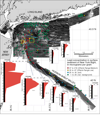
Figure 2. Map of the area offshore of the New York-New Jersey metropolitan region showing topographic features on the sea floor (gray scale), dumpsites (areas enclosed by yellow lines), lead concentrations in surface sediments (colored dots), and subsurface accumulation of lead (profiles with concentrations elevated above background values in red). The highest concentrations of lead (and other contaminants) are in the upper Hudson Shelf Valley and extend as far as 80 km downvalley from the original dumpsite.