This document is also available in pdf format: ![]() fs-40-99.pdf
fs-40-99.pdf
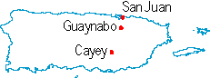
At 7 p.m. on Monday, Sept. 21, 1998, the eye of Hurricane Georges made landfall near Yabucoa and Humacao on the east coast of Puerto Rico (fig. 1). Hurricane Georges traversed the island from east to west, lashing furiously at urban and rural areas indiscriminately with estimated sustained winds of 115 miles per hour and gusts of 150 miles per hour. The storm had a minimum central pressure of 957 millibars and was classified as a Category 3 Hurricane on the Saffir-Simpson Scale. By 1 a.m. the next day, Hurricane Georges had left the island severely damaged and flooded. Hurricane Georges produced heavy rains over Puerto Rico, especially in the central interior mountains. The U.S. Geological Survey (USGS) rain gage network reported totals that ranged from less than 4 inches to about 26 inches near the center of the island (fig. 2).
|
|
On Sept. 22, most of the mountainous interior and the northern and southeastern coasts experienced severe floods. The worst flooding occurred in the river basins of the Río Grande de Añasco, Río Culebrinas, Río Camuy, Río Grande de Arecibo, Río de la Plata, Río Patillas, and Río Maunabo. Floodwaters inundated urban areas and communities, washing away and damaging homes, businesses, vehicles, bridges, and roads. Fortunately, there were no deaths directly associated with the passage of the hurricane over Puerto Rico. Damage to the island infrastructure was enormous. The total damage in Puerto Rico was estimated at 1.9 billion dollars. Many landslides occurred on the slopes of the mountainous interior, causing several towns to be isolated for several days. The USGS collected peak stage and discharge information from the streamflow-gaging network throughout the island. High-water marks were surveyed shortly after the event.
The USGS maintains and operates a real-time hazard alert network throughout Puerto Rico in cooperation with local government agencies. The network consists of 122 hydrologic data-collection sites equipped with satellite telemetry instrumentation. It includes streamflow, lake-stage, rainfall, and meteorological stations. Data collected at these stations are transmitted to a geostationary satellite, which in turn transmits the information to a receiving station in San Juan. The received data are interpreted by computer, and the data are made available to cooperating agencies. The stage and streamflow data also are made available on the World Wide Web at http://pr.water.usgs.gov and http://vi.water.usgs.gov. This is the only real-time hazard alert network in the Caribbean, and it has proved useful to government agencies during storms and floods. The USGS provided this important scientific information before, during, and after Hurricane Georges.
A 1998 study of the coral reef around Culebra, a small island off the east coast of Puerto Rico, revealed that the rapid recovery observed following the devastation of the reef by Hurricane Hugo in Sept. 1989 had slowed (fig. 3). In 1991, observation by divers showed hurricane damage to the reefs to be extensive. The most obvious effect of the storm was the almost total destruction of the elkhorn coral, a principal reef builder in the Caribbean; virtually all colonies larger than 1 meter were overturned and fragmented. Finger and staghorn corals also were greatly affected. Large quantities of these delicate branching corals had been reduced to rubble, forming steep slopes that buried other corals. Despite extensive damage to the reefs, abundant evidence of post-hurricane recruitment and regrowth was noted during 1991 and 1994.
| Figure 3. In 1959, this large Colpophyllia natans (a type of brain coral) had a star coral attached at left and a species of Diploria on the right. In 1988, the star coral is missing (note cavity in foreground), but the Diploria at right remained (Hurricane Donna impacted this area in Sept. 1960). In 1998, the brain coral is slightly bleached, and the Diploria to the right is even more bleached. The brain coral is mostly dead, and it is infested with algae and sea whips. |
| Figure 4. Excerpt from map showing susceptibility to landslides in the municipality of Comer�o, Puerto Rico. |
High-energy storms, such as Hurricane Georges, regularly bring intense and prolonged rainfall to Puerto Rico. These events have triggered hundreds of landslides in the mountainous areas of the island where hillslopes are steep and mean annual rainfall is high. Each year, landslides cause extensive damage to property, and they occasionally result in loss of life. Population density in Puerto Rico is high, and it is increasing. This increase is accompanied by the use of less desirable construction sites, and, as a result, human populations are becoming more vulnerable to landslide hazards. To address this problem, a map showing landslide susceptibility in Comerío was published in 1998 (fig. 4). The map was compiled using a methodology developed by the USGS in an earlier study in the mountains of eastern Puerto Rico; the method uses topographic, geologic, and land-use information to categorize all hillslopes into zones of low, moderate, or high landslide susceptibility.
Puerto Rico and the Virgin Islands exist on microplates located along a plate boundary between the Caribbean plate and the North American plate. The North American plate moves west relative to the Caribbean plate, a motion that grinds the plates together and results in earthquakes, massive seafloor landslides, and tsunamis. Recorded tsunamis caused about 100 deaths in 1946 and 91 deaths in 1918 in the region. The USGS has studied earthquake locations beneath the islands, and has concluded that the main plates (the Caribbean plate to the south and the North American plate to the north) are bent down beneath the micro-plates that carry the islands, and they may even be in contact at great depths (perhaps 100 kilometers beneath the surface). Stresses at this contact may partly explain the presence of the Puerto Rico trench, the deepest spot in the Atlantic, to the north of Puerto Rico. The down-warping of the trench results in tilting of the limestone platform that surrounds Puerto Rico, and it probably causes the detachment of great slabs of rock that have slid down into the Puerto Rico trench. If the slides occur abruptly, perhaps triggered by earthquakes, these massive movements of the ocean floor may generate tsunamis. Tsunamis also can be generated by abrupt offsets of the seafloor directly caused by earthquakes.
|
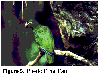
Figure 5. Puerto Rican Parrot. |
The USGS is participating in an interagency effort to reintroduce captive-bred Puerto Rican parrots (fig. 5) into native habitat on Puerto Rico. The parrot once ranged widely across the island, but now it is one of the most endangered bird species in the West Indies; only a few dozen parrots remain in the wild. The parrots face a variety of problems that affect their ability to survive and reproduce, including predators (red-tailed hawks and rats) and botflies, a parasite that kills nestlings. A successful captive breeding program has created the potential for a second wild population to be introduced in north-central Puerto Rico.
| Figure 6. Aedes aegypti mosquito. |
Dengue fever, a viral disease transmitted by the mosquito Aedes aegypti (fig. 6), can spread rapidly in explosive epidemics. More than a million people per year worldwide are afflicted by dengue, the most significant mosquito-borne disease affecting humans. The incidence of dengue has risen, and dengue epidemics have occurred with increasing frequency in the Caribbean. In Puerto Rico, dengue is a seasonal disease estimated to be responsible for more than 1,000 hospitalizations annually. Dengue transmission is influenced by the behavior of Aedes aegypti, the movement and distribution of humans, and virus development within the mosquito. The role of each of these factors is poorly understood, in part, because of the absence of studies on the spatial-temporal patterns of dengue cases. In an effort to add a geographic component to the existing Puerto Rico dengue surveillance program, a project funded cooperatively by the USGS, the Centers for Disease Control and Prevention (CDC), and the Puerto Rico Department of Health was begun in 1994. The project employed a geographic information system to study the spatial and temporal distribution of dengue cases reported to the CDC's dengue surveillance system. Significant dengue case clustering was identified at very short distances (most likely within households) over short time periods (3 days or less). This was probably a result of multiple feeding behavior on the part of the Aedes aegypti mosquito.
The population of Puerto Rico has increased 15 percent from 1980 to 1995 (fig. 7); however, the total freshwater per capita withdrawals decreased. Total freshwater per capita withdrawals in 1995 were 154 gallons per day per person compared to 176 gallons per day per person in 1985--that decrease in water use may be attributed to the implementation of water conservation programs primarily in industry and agriculture.
| Figure 7. Population and water-use trends in Puerto Rico. |
Puerto Rico enjoys a tropical maritime climate with an average of 72 inches of rain annually. Droughts occur, but they are infrequent. The most recent drought was during 1993-94, and it affected the San Juan area. Water reserves at the Loíza and La Plata reservoirs, which provide potable water to more than 750,000 people in the San Juan area, were reduced to below their critical levels. During the drought, intensive rationing was implemented. This drought increased the demand for ground-water supplies, and it adversely affected the economy of Puerto Rico.
The USGS Water, Energy, and Biogeochemical Budget Program (WEBB) began in 1991 at five locations in the United States, including one in Puerto Rico (fig. 1). The Puerto Rico research site consists of the U.S. Forest Service-administered Luquillo Experimental Forest and the Río Grande de Loíza drainage basin, an agriculturally developed watershed. This combined region serves as a terrestrial laboratory for the study of issues related to the global loss of tropical forest and the associated changes in land-use practices. The research focuses on geomorphic and biogeochemical processes that control the movement and transformation of water, energy, bedrock weathering products, and nutrients. The study examines erosion processes, soil development, nutrient cycling, and hillslope and fluvial transport of sediment and dissolved chemicals. One important finding to date is that intense agricultural practices of the 19th and early 20th century have resulted in high suspended sediment yields many decades after farming ceased. Sediment was eroded from the hillslopes while they were being farmed, and it was then deposited at the base of the hillslopes. Since then, storm flows have episodically moved the sediment from the base of the hillslopes downstream where it is deposited in reservoirs or coastal estuaries and coastal waters where coral reefs are located. The sediment and associated contaminants negatively affect the water quality and organisms in these areas. Water budgets have also been developed to show how much precipitation, stream runoff, ground-water loss, and evapotranspiration have occurred in each watershed during the 1990's (fig. 8). The water budgets are strongly controlled by elevation and location with respect to prevailing (trade) winds. More information about this program can be found at http://pr.water.usgs.gov/public/webb.
| Figure 8. Average water budgets of four watersheds in eastern Puerto Rico, water years 1991 to 1997. Inputs include rainfall, cloud drip, and infiltration from septic tanks. Outputs include runoff, ground-water flow, and extraction for public consump-tion. Evapotranspiration is estimated as the difference between inputs and outputs. |
|
The USGS has 78
|
USGS State Representative USGS Home Page: Reports and products: |