Contents
This report is also available as a PDF.
Nitrogen and phosphorus are essential nutrients for plant and animal growth, but excessive amounts can promote nuisance growths or blooms of algae and other aquatic plants in streams, lakes, and estuaries. In turn, algal blooms can impair the suitability of water for municipal supplies, recreation, fishing, and wildlife. In 1997, the U.S. Geological Survey (USGS) began an assessment of nutrients in the lower Tennessee River Basin as part of the National Water-Quality Assessment (NAWQA) Program. Initial assessments focused on nutrients because officials from Federal, State, and local resource-management and regulatory agencies identified nutrients in surface waters as an issue of concern. In 1996, State water-quality regulatory agencies listed overenrichment of nutrients as the cause of impairment in 37 stream segments and in 2 lakes within the lower Tennessee River Basin. Understanding the relation between the source and transport of nutrients within a watershed can assist resource managers and policymakers in forming sound nutrient-management decisions. This report compares nutrient inputs from nonpoint and point sources and nutrient outputs in selected basins in the lower Tennessee River Basin as summarized from the comprehensive report by Hoos and others (2000), which describes nutrient transport within the lower Tennessee River Basin.
|
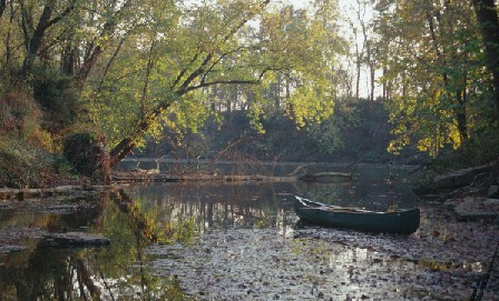
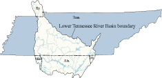
| The lower Tennessee River Basin drains about 19,500 square miles, mostly in Middle Tennessee and northern Alabama, and small areas of Kentucky, Georgia, and Mississippi. The major land uses in the basin include forest (51 percent), pasture (34 percent), and cropland (6 percent). The Tennessee Valley Authority constructed six main stem reservoirs and three tributary reservoirs in the lower Tennessee River Basin for power generation, navigation, and flood control. About 1.5 million people residing in the basin rely heavily on these reservoirs for drinking-water supplies and recreational activities. Surface water is the primary source of drinking water, providing about 160 million gallons a day to about 560,000 people in the basin. |
| AccessibilityFOIAPrivacyPolicies and Notices | |
 |
|