
|
|
|
|
|
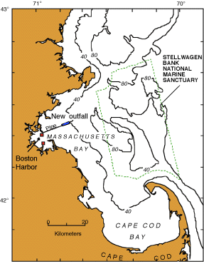
| Figure 1. Massachusetts and Cape Cod Bays, present sewage outfalls in Boston Harbor (red squares), location of new ocean outfall (blue rectangle) for treated Boston sewage in western Massachusetts Bay, and the location of the Stellwagen Bank National Marine Sanctuary. The 40- and 80-m depth contours are also shown. |
 |