

|
|
|
|
|
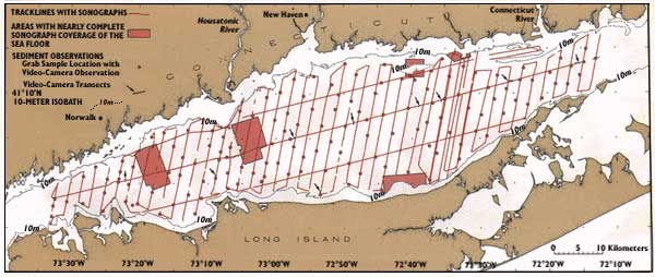
| Figure 2. Locations of sidescan sonographs, grab samples, and video-camera observations used to infer the distribution and characteristics of sea-floor sedimentary environments within the Long Island Sound estuary. The 10-meter (33-foot) depth contour delineates the shoreward limit of the study area along the Connecticut and Long Island coasts. |
 |