

|
|
|
|
|
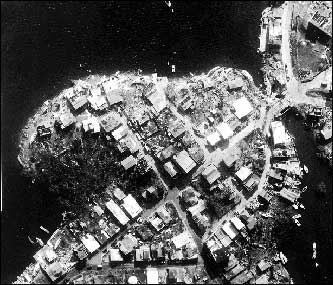
| Aerial photograph of Ensenada Honda on the island of Culebra taken in early October, 1989, showing severe damage to coastal structures due to Hurricane Hugo. North is to the left. Approximately 100 vessels out of 300 that took shelter in the "hurricane-proof" harbor were destroyed and litter the shoreline as a result of the storm. |
 |