Coastal and Marine Geology Program
> Coastal Erosion of Southern Lake Michigan
Antarctica - The Dynamic Heart of It All
USGS
Fact Sheet
Return to:
Home Page
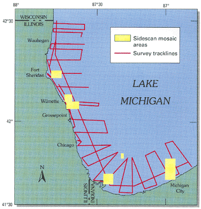
Map of southern Lake Michigan showing areas surveyed using sidescan sonar imagery and seismic reflection track lines. Together, these data provide the basis for preparing lake-bottom maps of physiography and sediment distribution.
Return to:
Home Page
Coastal and Marine Geology Program
> Coastal Erosion of Southern Lake Michigan
[an error occurred while processing this directive]