General Information Product 82
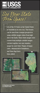
Each of the 50 States in the United States is beautiful in its own way. That beauty can be seen from a unique perspective using satellite images taken from high above the Earth. These State images were created from multiple satellite images stitched together into one seamless image for each State. Names of major cities, administrative boundaries, and State flags have been added. |
Version 1.0 Posted October 2008 For additional information contact: Part or all of this report is presented in Portable Document Format (PDF); the latest version of Adobe Reader or similar software is required to view it. Download the latest version of Adobe Reader, free of charge. |
U.S. Geological Survey, 2008, See your State from space!: U.S. Geological Survey General Information Product 82, 2 p.

![]() U.S. Department of the Interior | U.S. Geological Survey
U.S. Department of the Interior | U.S. Geological Survey
URL: http://pubsdata.usgs.gov/pubs/gip/82/index.html
Questions or Assistance: Contact USGS
Last modified: Wednesday, 30-Nov-2016 12:19:02 EST
