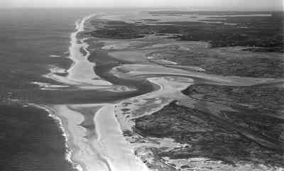
Figure 15.
Aerial photograph of the embayed coastline from Nauset to Chatham. The drowned lows were formed when buried ice of a sublobe of the South Channel lobe melted out. Headland erosion to the north of Nauset and longshore transport have formed the barriers and closed off the embayments (photo by Dan Blackwood, USGS).
 |