
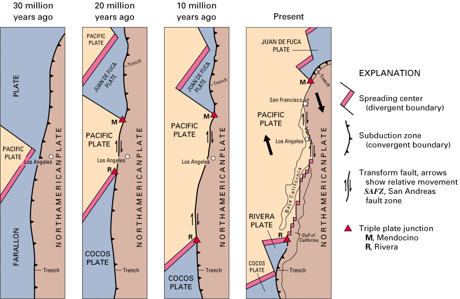
These four diagrams illustrate the shrinking of the formerly very large Farallon Plate, as it was progressively consumed beneath the North American and Caribbean Plates, leaving only the present-day Juan de Fuca, Rivera, and Cocos Plates as small remnants (see text). Large solid arrows show the present-day sense of relative movement between the Pacific and North American Plates. (Modified from USGS Professional Paper 1515).
![]() U.S. Department of the Interior |
U.S. Geological Survey
U.S. Department of the Interior |
U.S. Geological Survey
URL: https://pubsdata.usgs.gov/pubs/gip/dynamic/Farallon.html
Page Contact Information: Molly Newbrough or Pubs Warehouse
Page Last Modified: Friday, July 11, 2025, 12:53:01 PM