
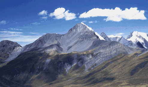
The convergence of the Nazca and South American Plates has deformed and pushed up limestone strata to form towering peaks of the Andes, as seen here in the Pachapaqui mining area in Peru. (Photograph by George Ericksen, USGS.)
![]() U.S. Department of the Interior |
U.S. Geological Survey
U.S. Department of the Interior |
U.S. Geological Survey
URL: https://pubsdata.usgs.gov/pubs/gip/dynamic/Nazca.html
Page Contact Information: Molly Newbrough or Pubs Warehouse
Page Last Modified: Friday, July 11, 2025, 12:56:36 PM