
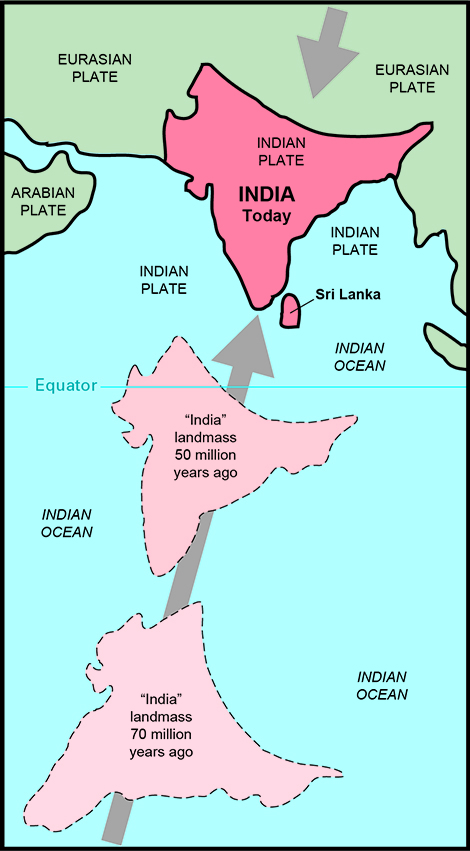
Artist's conception of the 6,000-km-plus northward journey of the "India" landmass (Indian Plate) before its collision with Asia (Eurasian Plate). Solid lines indicate present-day continents in the Indian Ocean region, but no geologic data exist to determine the exact size and shape of the tectonic plates before their present-day configurations. The dashed outlines for the "India" landmass are given for visual reference only, to show the inferred approximate locations of its interior part in the geologic past. The "India" landmass was once situated well south of the Equator, but its northern margins began to collide against the southward-moving Eurasian Plate about 40 to 50 million years ago (see text).
The Himalayas and the Tibetan Plateau to the north have risen very rapidly. In just 50 million years, peaks such as Mt. Everest have risen to heights of more than 9 km. The impinging of the two landmasses has yet to end. The Himalayas continue to rise more than 1 cm a year -- a growth rate of 10 km in a million years! If that is so, why aren't the Himalayas even higher? Scientists believe that the Eurasian Plate may now be stretching out rather than thrusting up, and such stretching would result in some subsidence due to gravity.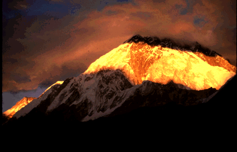
Sunset view of towering, snow-capped Mt. Everest, from the village of Lobuche (Solu-khumbu), Nepal. (Photograph by Gimmy Park Li.)
Fifty kilometers north of Lhasa (the capital of Tibet), scientists found layers of pink sandstone containing grains of magnetic minerals (magnetite) that have recorded the pattern of the Earth's flip-flopping magnetic field. These sandstones also contain plant and animal fossils that were deposited when the Tethys Sea periodically flooded the region. The study of these fossils has revealed not only their geologic age but also the type of environment and climate in which they formed. For example, such studies indicate that the fossils lived under a relatively mild, wet environment about 105 million years ago, when Tibet was closer to the equator. Today, Tibet's climate is much more arid, reflecting the region's uplift and northward shift of nearly 2,000 km. Fossils found in the sandstone layers offer dramatic evidence of the climate change in the Tibetan region due to plate movement over the past 100 million years.
![]() U.S. Department of the Interior |
U.S. Geological Survey
U.S. Department of the Interior |
U.S. Geological Survey
URL: https://pubsdata.usgs.gov/pubs/gip/dynamic/himalaya.html
Page Contact Information: Molly Newbrough or Pubs Warehouse
Page Last Modified: Friday, July 11, 2025, 12:53:02 PM