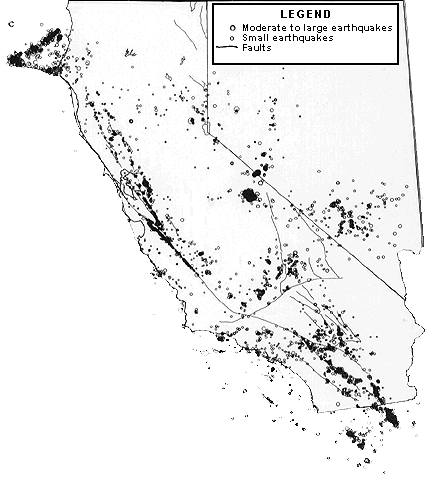
Earthquakes of magnitude 1.5 and larger recorded in 1980 on the San
Andreas and other large faults in California and Nevada
(data compiled by Jerry P. Eaton, USGS, and others)
The largest historical earthquakes that occurred along the San Andreas fault were those in 1857 and 1906 (see map).


![]() U.S. Department of the Interior |
U.S. Geological Survey
U.S. Department of the Interior |
U.S. Geological Survey
URL: http://pubsdata.usgs.gov/pubs/gip/earthq3/along.html
Page Contact Information: GS Pubs Web Contact
Page Last Modified: Wednesday, 30-Nov-2016 12:12:29 EST