The San Andreas fault forms a continuous narrow break in the Earth's crust that extends from northern California southward to Cajon Pass near San Bernardino. Southeastward from Cajon Pass several branching faults, including the San Jacinto and Banning faults, share the movement of the crustal plates. In this stretch of the fault zone, the name "San Andreas" generally is applied to the northeastern most branch.
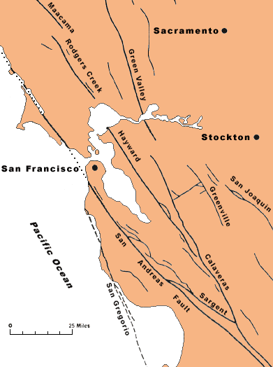
The complex network of faults that make up the San Andreas fault system in central California is shown in the next figure.


![]() U.S. Department of the Interior |
U.S. Geological Survey
U.S. Department of the Interior |
U.S. Geological Survey
URL: http://pubsdata.usgs.gov/pubs/gip/earthq3/where2.html
Page Contact Information: GS Pubs Web Contact
Page Last Modified: Wednesday, 30-Nov-2016 12:12:23 EST