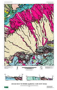
The Riverside quadrangle lies along the eastern edge of the Basin and Range province
in southeastern Nevada. The map area extends from the Virgin Mountains
northward to the edge of Mormon Mesa, and is traversed in its northern
part by the narrow, incised valley of the Virgin River. Most of the map
area lies in the southwestern part of the Virgin River depression (Bohannon
and others, 1993).
The Virgin River depression, about 28 km wide, lies between the Mormon Mountains
(maximum altitude 2,260 m) and East Mormon Mountains to the northwest
and the Virgin Mountains (maximum altitude 2,356 m) to the southeast
and east. The Mormon Mountains are within the Sevier thrust belt, where
a thin sheet of allochthonous lower Paleozoic strata tectonically overlies
an autochthon consisting of Paleozoic and lower Mesozoic rocks. Detachment
faulting associated with middle Miocene extension has produced strong
local tilts, exposing Precambrian rocks at a few localities (Axen and
others, 1990), notably in the East Mormon Mountains. The Virgin Mountains are entirely east of the thrust belt and they
contain a complete, but dismembered section of autochthonous Paleozoic
and Mesozoic strata. Strong uplift in the Virgin Mountains associated
with middle Miocene extension and strike-slip faulting has resulted in
the exposure of Proterozoic crystalline rocks along the entire southwest
edge of the Virgin River depression.
Proterozoic rocks in the Riverside quadrangle and surrounding areas have been
mapped and studied by Beal (1965). Where possible, we have tried to conform
to his terminology. Parts of the rock descriptions used here, primarily
mineralogical and textural information, are taken from Beal (1965).
|
|
Part or all of this report is presented in Portable Document Format. The latest
version of Adobe Acrobat Reader or similar software is required
to view it. If you wish to download the latest version of Acrobat
Reader free of charge, click here.
|
|
