GROUND WATER ATLAS of the UNITED STATES
Introduction and National Summary
Introduction
There are two different files for each illustration
- A 72 ppi GIF file, suitable for screen viewing is accessed
through the thumbnail image.
- An eps file, suitable for downloading to be printed or edited
is accessed through the "eps file" link. Most files
are Adobe Illustrator 6.0, exceptions are noted. These files
have been compressed with GNU's gzip utility. If your web browser
defaults to a screen display of the file, turn on the "Load
to local disk" option before downloading. Download and process
these eps files as ascii, not binary.
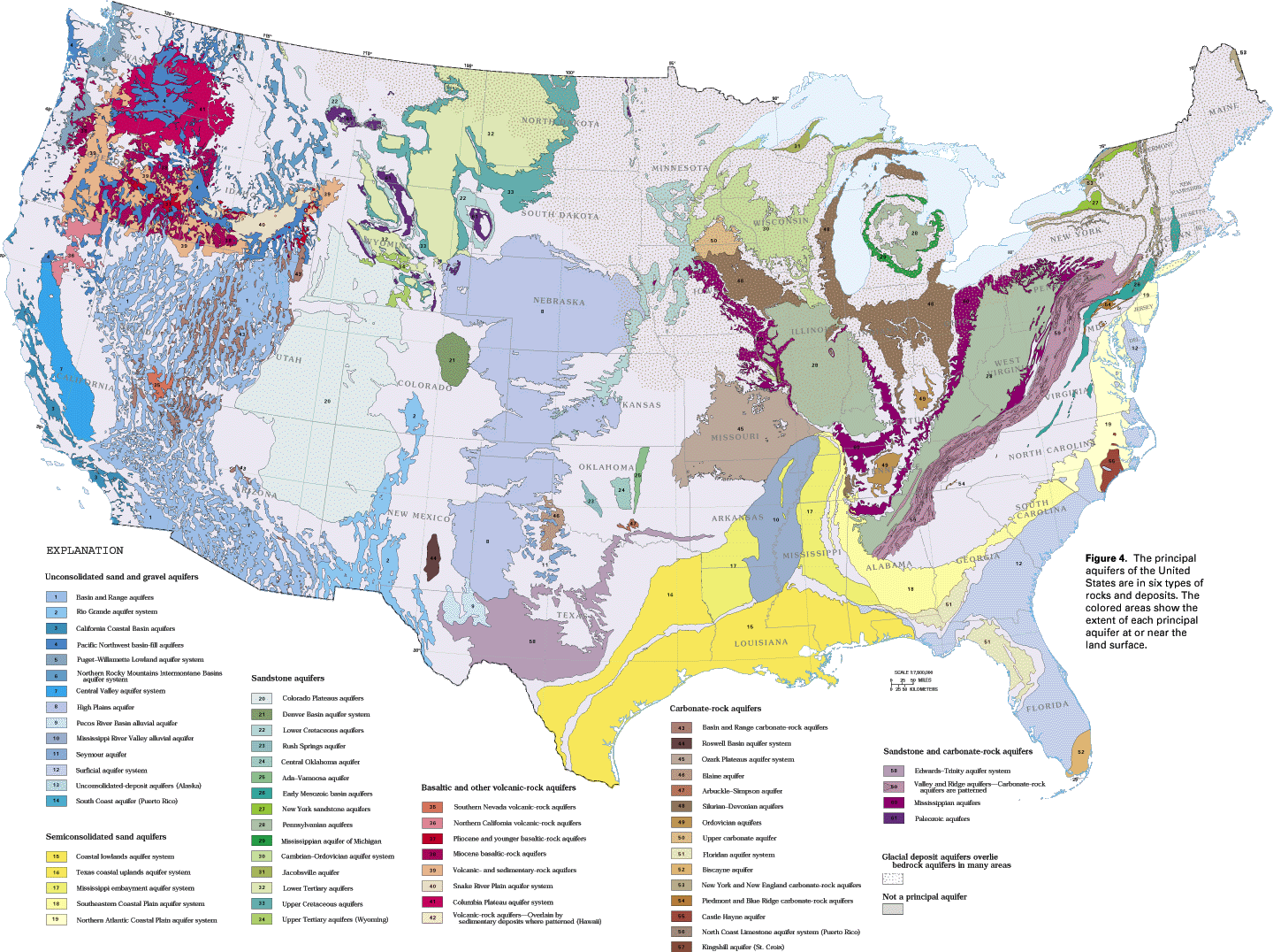
Nationwide map of principal aquifers
Figure 4a Map showing the distribution of the principal
aquifers of the contiguous United States. (440K)
 editable eps
file A004_us.eps.gz (2.3MB compressed)
editable eps
file A004_us.eps.gz (2.3MB compressed)
Figure 4b Map showing the distribution of the principal
aquifers of Hawaii, Alaska, Puerto Rico and the Virgin Islands. (56K)
 editable eps
file A004_b.eps.gz (552KB compressed)
editable eps
file A004_b.eps.gz (552KB compressed)
 editable eps
file A004_us.eps.gz (2.3MB compressed)
editable eps
file A004_us.eps.gz (2.3MB compressed)  editable eps
file A004_b.eps.gz (552KB compressed)
editable eps
file A004_b.eps.gz (552KB compressed)