GROUND WATER ATLAS of the UNITED STATES
Arkansas, Louisiana, Mississippi
HA 730-F
Coastal lowlands aquifer system
(figures 46-64)
Introduction (Click to view thumbnails and download
figures)
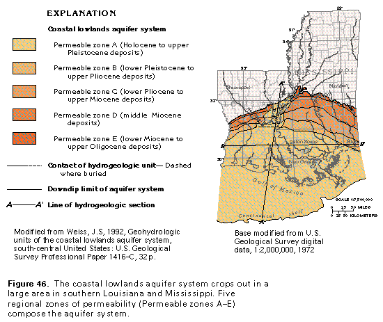
- Figure 46 Map showing extent
of the aquifer system and permeable zones
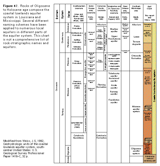
- Figure 47 Correlation chart
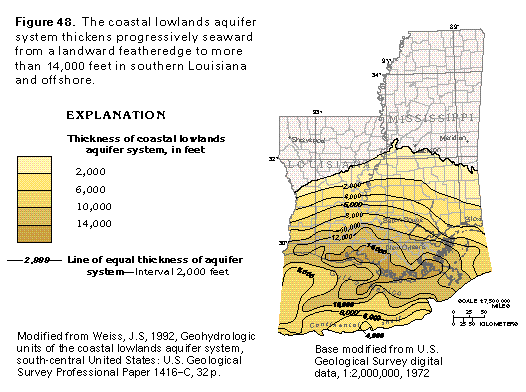
Thickness and extent
(Click to view thumbnails and download figures)
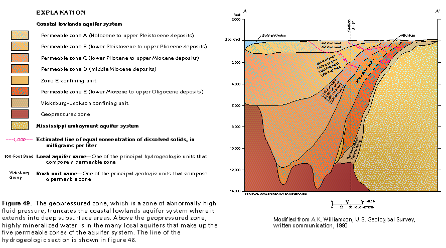
Hydrogeologic units
(Click to view thumbnails and download figures)
- Figure 51 Map showing
the thickness of permable zone A
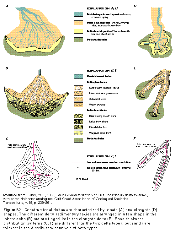
- Figure 52 Diagrams
of constructional deltas
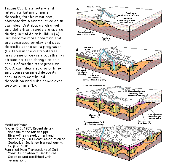
- Figure 53 Diagramatic
section showing a constructive delta
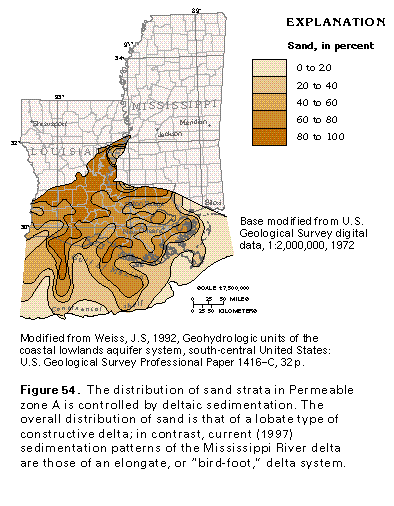
- Figure 54 Map showing
sand in percent
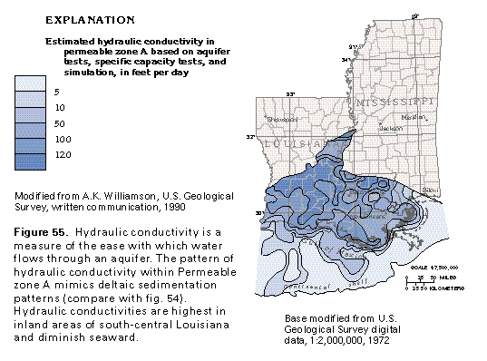
- Figure 55 Map showing
estimated hydraulic conductivity
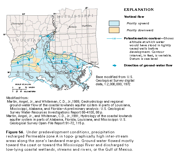
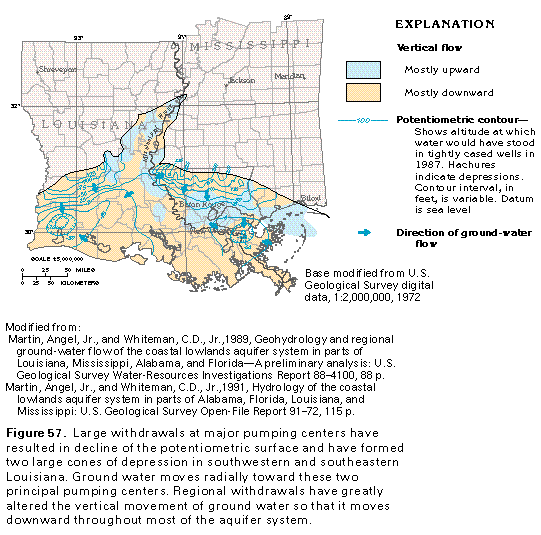
Ground-water flow
(Click to view thumbnails and download figures)
Ground-water quality
(Click to view thumbnails and download figures)
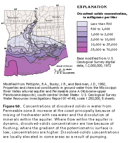
- Figure 58 Map
showing dissolved-solids concentration
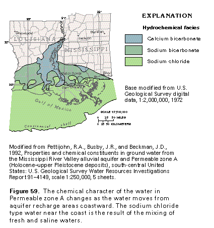
- Figure 59 Map
showing hydrochemical facies
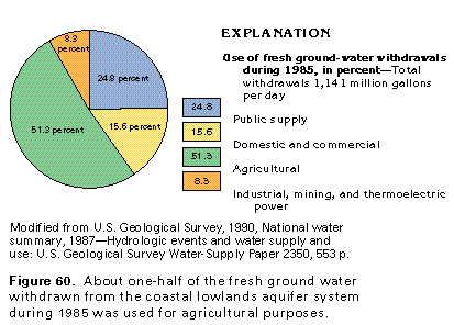
- Figure 60 Chart
showing the use of fresh ground-water withdrawals during 1985
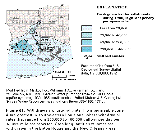
- Figure 61 Map
showing fresh ground-water withdrawals during 1980
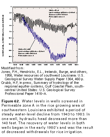
- Figure 62 Graph
showing water level in well
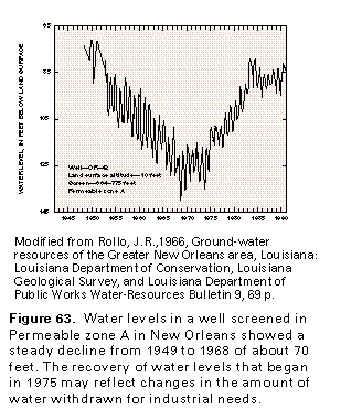
- Figure 63 Graph
showing water level in well
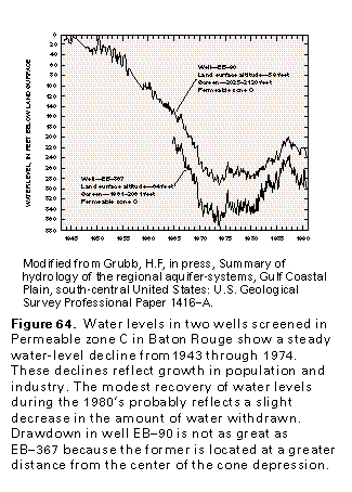
- Figure 64 Graph
showing water level in well