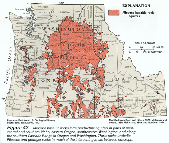
Miocene basaltic-rock aquifers (fig. 42) consist primarily of thick basaltic lava flows. The aquifers are most productive in the Columbia Plateau of northeastern Oregon and southeastern Washington where the aquifers are thickest. The maximum thickness of the aquifers is estimated to be as much as about 15,000 feet in the southern part of the Columbia Plateau. These aquifers generally yield freshwater but locally yield saltwater. Most of the fresh ground-water withdrawals are used for agricultural (primarily irrigation) purposes.
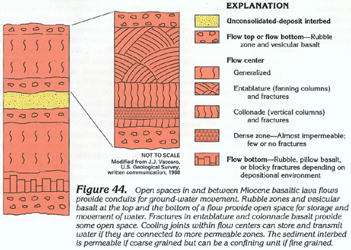
Miocene basaltic-rock aquifers consist primarily of flood-type basaltic lava flows that were extruded from major fissures; some flows extend along former lowlands for about 100 miles. Many of the flows have been folded into anticlines and synclines. Where these folded flows are exposed, the landscape is characterized by prominent ridges formed by the flows (fig. 43). Structural features in the flows include cooling joints (entablature and colonnade), rubble zones, and faults. Some of these structural features are shown in figure 44. Many structural features in these flows are similar to structural features in flows that compose most of the Pliocene and younger basaltic-rock aquifers. Open spaces along cooling joints and fractures and in rubble and interflow zones are less common in these flows than in Pliocene and younger basaltic lava flows. In the Miocene basaltic lava flows, some of the open spaces that initially formed during cooling or subsequently formed during folding have been filled with secondary clay minerals, calcite, silica, or unconsolidated alluvial deposits emplaced by streams or in lakes. Except where such fill materials are coarse grained, they tend to decrease markedly the permeability of the Miocene basaltic-rock aquifers.
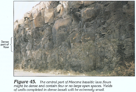
Permeability of the Miocene basaltic-rock aquifers is extremely variable. Yields of wells penetrating these aquifers range from 1 to several thousand gallons per minute. Maximum specific-capacity values are about 3,000 gallons per minute per foot of drawdown. Some interbeds of unconsolidated deposits that contain water under unconfined and confined conditions can yield as much as 100 gallons per minute. The smallest yields are obtained from wells that were completed either in the dense, central parts of flows where open spaces are few (fig. 45) or in the interbeds that consist of fine-grained unconsolidated deposits when such wells do not penetrate numerous open spaces in the interval above their completion depth. The largest yields are obtained from wells that penetrate numerous open spaces. Generally, the more water-contributing interflow zones that are penetrated by a well, the greater the well yield that can be obtained.