GROUND WATER ATLAS of the UNITED STATES
Idaho, Oregon, Washington
HA 730-H
Volcanic- and sedimentary-rock aquifers
There are two different files for each illustration
- A 90 ppi JPEG file, suitable for screen viewing is accessed
through the thumbnail image.
- A tiff file is accessed through the "tiff file"
link. All files are Adobe Photoshop. These files have been compressed
with GNU's gzip utility. If your web browser defaults to a screen
display of the file, turn on the "Load to local disk"
option before downloading. Download and process these tiff files
as ascii, not binary.
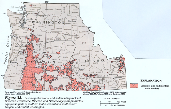
Figure 38 Map showing location of volcanic-
and sedimentary-rock (316K)
 downloadable
tiff file H038.tif.gz (2.3MB
compressed)
downloadable
tiff file H038.tif.gz (2.3MB
compressed)
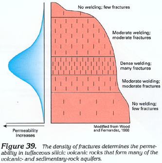
Figure 39 Diagram showing relationship between
density and permeability of fractures (116K)
 downloadable
tiff file H039.eps.gz (804K
compressed)
downloadable
tiff file H039.eps.gz (804K
compressed)
Figure 40 Photograph showing fractures in silicic
volcanic rocks (200K)
 downloadable
tiff file H040.eps.gz (1.2MB
compressed)
downloadable
tiff file H040.eps.gz (1.2MB
compressed)
Figure 41 Photograph showing springs issuing
from silicic volcanic rocks (216K)
 downloadable
tiff file H041.eps.gz (1.6MB
compressed)
downloadable
tiff file H041.eps.gz (1.6MB
compressed)
Return to Volcanic- and sedimentary-rock
aquifers text
Return to HA 730-H table of contents
Return to Ground Water Atlas home page
 downloadable
tiff file H039.eps.gz (804K
compressed)
downloadable
tiff file H039.eps.gz (804K
compressed) 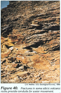 downloadable
tiff file H040.eps.gz (1.2MB
compressed)
downloadable
tiff file H040.eps.gz (1.2MB
compressed) 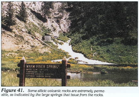 downloadable
tiff file H041.eps.gz (1.6MB
compressed)
downloadable
tiff file H041.eps.gz (1.6MB
compressed)