GROUND WATER ATLAS of the UNITED STATES
Alaska, Hawaii, Puerto Rico and the U. S. Virgin Islands
HA 730-N
Hawaii Regional summary
There are two different files for each illustration
- A 72 ppi GIF file, suitable for screen viewing is accessed
through the thumbnail image.
- An eps file, suitable for downloading to be printed or edited
is accessed through the "eps file" link. Most files
are Adobe Illustrator 6.0, exceptions are noted. These files
have been compressed with GNU's gzip utility. If your web browser
defaults to a screen display of the file, turn on the "Load
to local disk" option before downloading. Download and process
these eps files as ascii, not binary.
Ground-Water Occurrence and Movement
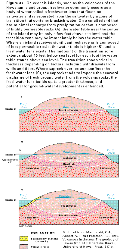
Figure 37 Cross sections showing the location of the
freshwater lens floating on a body of saltwater within an aquifer
(57K)
 editable eps
file N037.eps.gz (104K compressed)
editable eps
file N037.eps.gz (104K compressed)
Figure 38 Cross section showing the vertically
extensive freshwater-lens system found in eastern Kauai (40K)
 editable eps
file N038.eps.gz (78K compressed)
editable eps
file N038.eps.gz (78K compressed)
Figure 39 Cross section showing the occurrence
of ground water in the volcanic-rock aquifers (62K)
 editable eps
file N039.eps.gz (267K compressed)
editable eps
file N039.eps.gz (267K compressed)
Figure 40 Map showing the location of wells
completed in the Hawaiian Islands (43K)
 editable eps
file N040.eps.gz (222K compressed)
editable eps
file N040.eps.gz (222K compressed)
 editable eps
file N037.eps.gz (104K compressed)
editable eps
file N037.eps.gz (104K compressed) 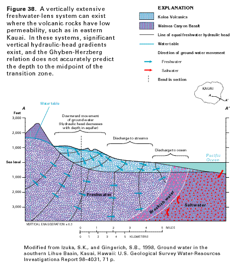 editable eps
file N038.eps.gz (78K compressed)
editable eps
file N038.eps.gz (78K compressed) 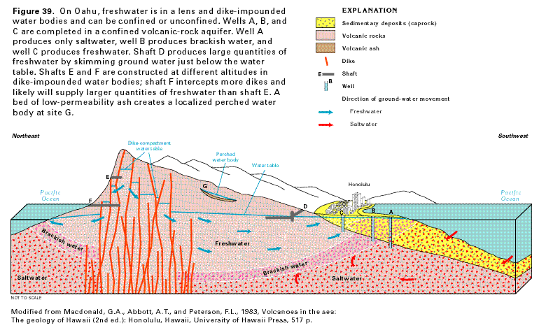 editable eps
file N039.eps.gz (267K compressed)
editable eps
file N039.eps.gz (267K compressed) 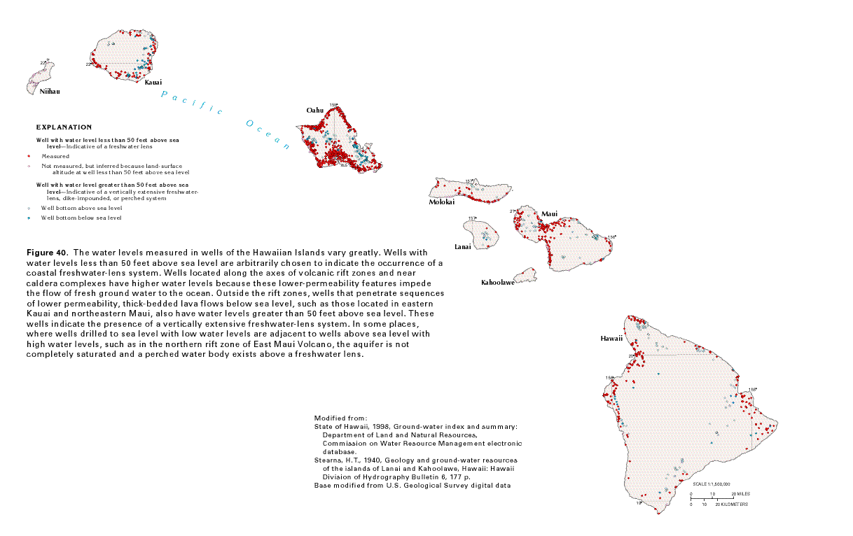 editable eps
file N040.eps.gz (222K compressed)
editable eps
file N040.eps.gz (222K compressed)