Miscellaneous Investigations Series I-1420 (NL-19)
This map is part of the Quaternary Geologic Atlas of the United States (I-1420). It was first published as a printed edition in 1987. The geologic data have now been captured digitally and are presented here along with images of the printed map sheet and component parts as PDF files. 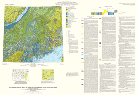 
|
Version 1.0 Posted October 2006
(This text-only version of the map is accessible as defined in Section 508 of the Rehabilitation Act of 1973, Amendments of 1998.)
|
Part or all of this report is presented in Portable Document Format (PDF); the latest version of Adobe Acrobat Reader or similar software is required to view it. Download the latest version of Acrobat Reader, free of charge or go to access.adobe.com for free tools that allow visually impaired users to read PDF files.
