
U.S. Geological Survey Geologic Investigations Series I-2737
U.S. Geological Survey Geologic Investigations Series I-2737
Earthquakes In and Near the Northeastern United States, 1638-1998
By Russell L. Wheeler, Nathan K. Trevor, Arthur C. Tarr, and Anthony J. Crone
Version 1.1
This map is presented in Portable Document Format. Adobe Acrobat Reader 4.0™ is required to view it. If you wish to download Acrobat Reader 4.0 free of charge, click here.
It is best to download a large PDF file to your hard drive rather than open it inside your browser. (A standard click may automatically open the PDF file inside the browser but doing so will result in a very slow load.) For guidance on how to do this, click here. Downloading the PDF file may take several moments but will be worth the wait. Once it is downloaded, open the PDF from your hard drive using Adobe Acrobat—it will load in a fraction of the time it would take to open the PDF over the internet.
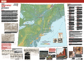
Map PDF file (16.6 MB)
Screen Friendlier Map PDF file (8.98 MB)
Medium Quality JPG Image file (9.63 MB)
Download earthquake catalog:
ZIPPED text file (15 KB)
(This catalog contains the list of earthquakes used to make this map.)
Download archive files:
Archive TAR.GZ (Unix) file (19.1 MB)
Archive ZIP (PC) file (19.8 MB)
To order a paper copy of this map, phone 1-888-ASK-USGS.