
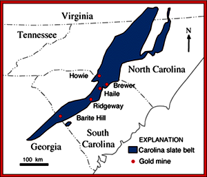
Figure 1. The Carolina slate belt and major gold mines (modified from Hatcher and Butler, 1979). |
Current U.S. Geological Survey (USGS) efforts in the slate belt are led by a multidisciplinary team focused on an integrated, multistate, and multiyear project that has the potential to result in a fundamental reinterpretation of the economic geology of the region. The slate belt is considered a scientific frontier because of the rapid pace of data acquisition by the USGS, academia, and private sector geologists and because emerging concepts of its geologic evolution are controversial. Establishing the origin of the gold deposits is important, not only in guiding exploration, but for more accurate assessment of the potential for the occurrence of new deposits throughout the southern Appalachians. These efforts may result in further industry exploration that may lead to discovery of new economically viable mineral deposits, which would have a broad economic impact on the region. Another goal is to find ways to prevent human activities related to gold extraction from remobilizing toxic metals found in these deposits, which could have potential harmful effects on the environment.
Fluid-inclusion data suggest that water-dominated fluids associated with the different styles of mineralization had a wide range of temperatures and contents of salt. Results indicate that during gold deposition in some deposits, gases were lost (for example, carbon dioxide), and that mixing of different types of water-rich fluids was necessary before gold precipitated; data for other deposits support a model of mixing of seawater and hydrothermal fluids. Efforts now underway will quantify the types of water required for the accumulation of gold in the deposits and the processes that resulted in gold deposition in each.
Radiogenic isotope data for lead, strontium, and neodymium show that the gold deposits have different compositions, a feature of considerable importance for successful exploration in the southern Appalachians. Radiogenic isotope compositions of neodymium and lead indicate that the gold deposits are underlain by deep-seated rocks (basements), which are not found west of the Carolina slate belt, but which occur as part of a trend that stretches to the northeast and southwest for hundreds of miles. This presence of basement rocks is a key feature that will lead to more precise regional exploration and assessment of the overall endowment of precious metals in the slate belt and adjacent regions.
Stable-isotope variations also provided new insights; for example, in agreement with field observations, mineralogic and geochemical variations, and fluid evolution, sulfur isotopic compositions in some of the deposits resemble those of a family of sea-floor mineral deposits known as volcanogenic massive sulfides. Aspects of other gold deposits in the slate belt, in contrast, resemble aspects of terrestrial geothermal systems in which metals were leached from volcanic and related rocks or from subvolcanic emanations. Our results thus indicate that the gold deposits in the slate belt illustrate a spectrum of submarine to subaerial environments during their formation, including deposition of some gold-bearing hydrothermal mineralization in volcaniclastic sediments by replacement below the sea floor. deposition of hydrothermal gold mineralization in mounds at the sea floor, deposition of gold mineralization in a subvolcanic porphyry setting possibly related to emerging volcanic edifices, and deposition in classic epithermal hot-springs-type volcanic environments.
Ongoing USGS research thus suggests that a variety of mineralizing processes were involved in the generation of the gold deposits and that distinct, though related, environments of ore deposition existed in this region during the period of mineralization. Local controls on the site within each of these deposits were imposed by unique geologic and structural conditions at each of the sites. These results suggest that different gold exploration strategies must be used for deposits associated with former shallow sea-floor environments than will be used for deposits associated with submarine-subaerial environments related to an emerging edifice. Exploration strategies will also depend on the character of the basements that underlie the southern Appalachians. The recognition of this variety of mineralization environments has important implications regarding exploration strategies in rocks from Georgia to Maine.
Ayuso, R.A., Seal, R.R., Foley, N.K., and Offield, T.W., 1998, Genesis of gold deposits in the Carolina slate belt, USA: Constraints from comparative mineralogy, trace elements, fluid evolution and isotopic variations [abs.]: Society of Mining Engineering, Abstracts with Program, Supplement to Mining Engineering, Annual Meeting, March 9-11, 1998, Orlando, Florida, p. 62.
Foley, N.K., Ayuso, R.A., Seal, R.R., II, and Offield, T.W., 1997, Fluid evolution and mineralogy of Au-bearing volcanogenic deposits in a regional geologic setting: Examples from the Carolina slate belt, USA [abs.]: Geological Society of America Abstracts with Programs, v. 29, no. 6, p. A59.
Hatcher, R.D., and Butler, J.R., compilers, 1979, Guidebook for the southern Appalachian field trip in the Carolinas, Tennessee, and northeastern Georgia (International Geological Correlation Programme, Project 27-Caledonide Orogen): Raleigh, N.C., North Carolina Geological Survey, 117 p.
Seal, R.R., II, Foley, N.K., Ayuso, R.A., and Offield, T.W., 1997, Genetic significance of regional sulfur isotope variations in gold deposits of the Carolina slate belt, South Carolina [abs.]: Geological Society of America Abstracts with Programs, v. 29, no. 6, p. A60.
|
For more information, please contact:
Robert A. Ayuso |
|
|
Mail Stop 954, National Center Reston, VA 20192 |
Telephone: (703) 648‚6347 E-mail: rayuso@usgs.gov |
|
U.S. Department of the Interior U.S. Geological Survey |
USGS Information Handout October 1998 |