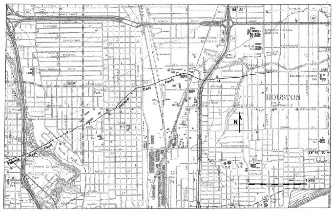
Figure 3. Map of Pecore East and eastern portion of Pecore West faults. Map symbols and scale are same as for maps 1 and 2; see figure 2 for location. Base from U.S. Geological Survey, Settegast 7 1/2-minute quadrangle, 1967.
Figure 4 | Contents | Back to Text