Skip Links

USGS - science for a changing world

U.S. Geological Survey Miscellaneous Field Studies Map MF–1913–A

In cooperation with the U.S. Forest Service

Mineral Resource Potential Map of the South Sierra Wilderness and the South Sierra Roadless Area, Inyo and Tulare Counties, California

By Michael F. Diggles

1987

Thumbnail of and link to report PDF (16.9 MB)Abstract

There are five areas with mineral resource potential and one area with geothermal energy potential in the South Sierra Wilderness and the South Sierra Roadless Area. The area south of Summit Meadows and the area south of Hogback Creek have moderate resource potential for tungsten and molybdenum in small skarn deposits. The area between Summit meadow and Hogback Creek and the area from south of Jackass Meadows to northwest of Granite Knob have low mineral resource potential for tungsten and molybdenum. The area south of and including Walker Creek has low mineral resource potential for lead and zinc. The area including and surrounding Monache Mountain has high geothermal energy resource potential.

  • Map PDF in standard resolution and compression (~41" x ~34"; 17 MB)
  • Map PDF in high resolution and low compression (~41" x ~34"; 257 MB)
  • This report is also available in print from:

    USGS Information Services, Box 25286,
    Federal Center, Denver, CO 80225
    telephone: 888 ASK-USGS; e-mail: infoservices@usgs.gov

For additional information:
Contact Information, Western Mineral and Environmental Resources Science Center, Menlo Park Office
U.S. Geological Survey
345 Middlefield Road, MS 901
Menlo Park, CA 94025-3591
http://minerals.usgs.gov/west/

This report is presented in Portable Document Format (PDF); the latest version of Adobe Reader or similar software is required to view it. Download the latest version of Adobe Reader, free of charge.


Suggested citation:

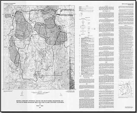
Diggles, M.F., 1987, Mineral resources potential map of the South Sierra Wilderness and the South Sierra Roadless Area, Inyo and Tulare Counties, California: U.S. Geological Survey Miscellaneous Field Studies Map MF–1913–A, scale 1:48,000. (Available at https://pubs.usgs.gov/mf/1987/1913a/.)


Accessibility FOIA Privacy Policies and Notices

Take Pride in America logo USA.gov logo U.S. Department of the Interior | U.S. Geological Survey
URL: http://pubsdata.usgs.gov/pubs/mf/1987/1913a/index.html
Page Contact Information: GS Pubs Web Contact
Page Last Modified: Thursday, 01-Dec-2016 12:10:34 EST