
U.S. Geological
Survey
Miscellaneous Field Studies MF-2354
Online version 1.0
Geologic Map of the Chewelah 30' x 60' Quadrangle, Washington and Idaho
By
Fred K. Miller
|
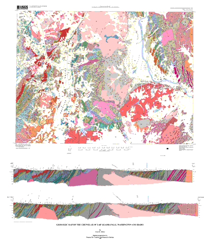
INTRODUCTION Rocks within the Chewelah quadrangle record a complex and varied structural history from the Late Proterozoic to the Eocene, one that is characterized by several discrete periods of igneous intrusion, folding, normal and reverse faulting, and repeated reactivation of faults during succeeding periods of faulting. The western third of the quadrangle includes a segment of the Kootenay arc, a highly faulted and folded allochthonous sequence of Middle and Late Proterozoic and Paleozoic rocks. Within the quadrangle these rocks have a consistent north-northeast strike. The Jumpoff Joe Fault sharply defines the east boundary of the Kootenay arc, juxtaposing it against coeval rocks of the Belt Supergroup and Paleozoic rocks that have distinctly different structural and lithostratigraphic characteristics. Much of the eastern half of the Chewelah quadrangle is underlain by the western part of the (informal) Priest River complex, which consists of intermixed, heterogeneous two-mica granitic rocks and highly recrystallized Middle Proterozoic rocks. The shallowly dipping Eocene Newport Fault separates the midcrustal crystalline rocks of the Priest River complex from an overlying, relatively thin, spoon-shaped, detached flap of essentially unmetamorphosed Belt rocks. Numerous Cretaceous plutons intrude the hanging-wall Belt rocks, and scattered, syntectonic Eocene nonmarine sedimentary and volcanic rocks are found chiefly in low-lying areas. Eocene normal faults associated with unroofing of the Priest River complex and development of the Newport Fault appear to be the youngest structures affecting rocks in the quadrangle. Granitic rocks that range in age from Triassic or Jurassic to Eocene and represent five discrete intrusive episodes form about 50 percent of the rocks in the area. |
 |
|
Files
Available for Download
|
||
|
File
Name
|
Description
|
File
Size
|
|
Files
for viewing and plotting
|
||
| Portable Document Format file of the map sheet of the geologic map for viewing onscreen |
7.7 MB
|
|
| Portable Document Format file of the map sheet containing the correlation and the description of map units |
176
KB
|
|
| Gzip'd file containing a PostScript file of the map sheet of the geologic map designed for plotting on a large format plotter |
8.3 MB
|
|
| Gzip'd file containing a PostScript file of the map sheet showing the correlation and description of map units designed for plotting on a large format plotter. |
10.6 MB
|
|
| Portable Document Format file of the accompanying pamphlet that contains the description of map units. |
152 KB
|
|
|
Metadata
and Readme Files
|
||
| Readme file in PDF format that describes how to use the database |
48
KB
|
|
| FGDC-compliant metadata for the database. An additional copy of this file is included with the compilation of the database |
40 KB
|
|
|
Data
|
||
| Tarred, gzip'd compilation of all files necessary to recreate the database originally assembled in Arc/Info. Included is an AML called import.aml that will automatically import the Arc export files making up this database package |
5.8 MB
|
|
Download a free copy of Adobe Acrobat Reader
For questions about the content of this report, contact Fred Miller
This report
will also available via print on demand from:
USGS Information
Services, Box 25286,
Federal Center, Denver, CO 80225
telephone: 303-202-4210; e-mail: infoservices@usgs.gov
URL of this page:
https://pubs.usgs.gov/mf/2001/2354
Maintained by: Michael Diggles
Created: January 30, 2001
Last modified: July 4, 2005 (mfd)