
U.S. Geological Survey Miscellaneous Field Studies Map MF-2341
Version 1.0
![]()
This report is presented in Portable Document Format. The latest version of Adobe Acrobat Reader or similar software is required to view it. If you wish to download the latest version of Acrobat Reader free of charge, click here.
PDF files for viewing and printing:
Map PDF file (509 KB)
(This version of the report is not accessible as defined in Section 508.)
Text-only Map PDF file (61 KB)
(This version of the report is accessible as defined in Section 508.)
Pamphlet PDF file (222 KB)
(This version of the report is accessible as defined in Section 508.)
Metadata file:
Metadata TEXT file (20 KB)
Download GIS files:
ZIPPED archive of ArcInfo, metadata, and readme files (2.9 MB)
ZIPPED archive of georeferenced image files of base map (7.6 MB)
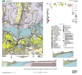
The online edition of this publication consists of a digital database, metadata, a print-optimized PDF file for the map sheet, a text-only description of the map sheet (PDF file) that is accessible as defined in Section 508 of the Rehabilitation Act, and a PDF file of the accompanying 17-page pamphlet, which is also accessible and contains interpretive text describing stratigraphy, structure, geologic hazards, geologic resources, and environmental issues, as well as a full description of geologic map units and a list of references cited.
A high-resolution plot of this map can be purchased at Information Services, U.S. Geological Survey (1-888-ASK-USGS).
![]()