U.S. Geological Survey Miscellaneous Field Studies Map MF–2387
U.S. Geological Survey Miscellaneous Field Studies Map MF–2387
Geologic Map of Hidden Hills and Vicinity, Mohave County, Northwestern Arizona
By
George H. Billingsley, Jessica L. Wellmeyer, Michelle Harr, and Susan S. Priest
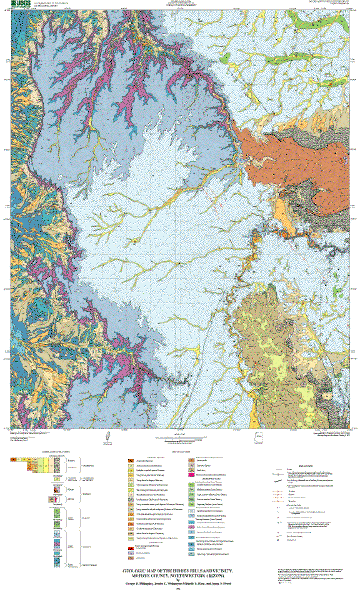 |
| This illustration is a .gif nonnavigable image of the USGS geologic-map plot of the Hidden Hills and vicinity, Mojave County, northwestern Arizona. A full-size, navigable map graphic can be plotted from the PostScript file (hhmap.eps). Note: The full-size plot is approximately 32 by 52 inches, requires a large-format plotter, and is best reproduced at 600 (or greater) dpi. |
| Files Available for Downloading | ||
|---|---|---|
| File Name | Description | File Size |
| Files for viewing and plotting | ||
| hhmap.pdf | Portable Document Format (PDF) file of the map sheet for viewing onscreen | 6.8 MB |
| hhmap.eps.gz | Encapsulated Postscript (EPS) version (compressed using gzip) of the map sheet for plotting on a large-format plotter; size: 32 x 52 inches | 8.1 MB (42.9 MB uncompressed) |
| hhgeo.pdf | PDF file of the accompanying map pamphlet for viewing and printing | 143 kB |
| hhgeo.txt | ASCII text file of accompanying map pamphlet | 69 kB |
| hhgeo.zip | Zip file containing two PDF files: the map sheet and the accompanying pamphlet | 6 MB |
| hhmap.zip | Zip file containing two files: the map sheet as an EPS file and the accompanying pamphlet as a Microsoft Word document | 8.6 MB |
| Metadata and Readme files | ||
| readme.txt | ASCII text file explaining the contents of the digital database and all the other files that make up this publication | 1 kB |
| mf2387.met.txt | FGDC-compliant metadata for the database | 30 kB |
| Data | ||
| hhdb.zip | Zip-file compilation of all files necessary to recreate the database, originally assembled in Arc/Info. Included is an AML file called import.aml that will automatically import the Arc export files making up this database package | 23 MB |
| hiddenhills.style | ArcMp style for map colors and symbolizing data | 552 kB |
| Mf2387_shapefiles.zip | Shapefiles and readme describing content of each file |
44.5 MB (60.3 MB uncompressed) |
For questions about the content of this report, contact Sue Priest.
Download Adobe Reader for free.
| Download help | PDF help | Geopubs main page | Western MF-Maps |
| U.S. Department of the Interior | U.S. Geological Survey | Geologic Division | Earth Surface Processes |
This report is available via print on demand.