
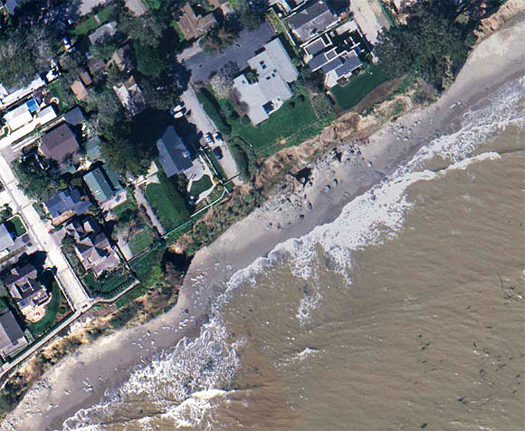
 Aerial photograph of the southern edge of Depot Hill, Santa Cruz, CA. Continued erosion along nearly vertical faults in the soft sedimentary rocks of the Purisima Formation has caused slow, but steady loss of developed home sites.
Files available for downloading:
- PDF version of this map (784 kb).
- Encapsulated PostScript version of this map (65.3 MB)
For questions about the scientific content of this report, contact Cheryl Hapke
Download a free copy of Adobe Reader
This report is available via print on demand.
| Help
| PDF help |
| Publications main page
| Miscellaneous Field Studies Maps |
| Department of the Interior
| U.S. Geological Survey |
| Geologic Division
| Coastal and Marine Geology|
| Privacy Statement
| Disclaimer
| Accessibility |
URL of this page is:
https://pubs.usgs.gov/mf/2002/2398/
Please send comments and suggestions, or report problems, to:
Michael Diggles
Updated: April 23, 2007 (bwr, mfd)