
U.S. Geological Survey Miscellaneous Field Studies Map MF-2389
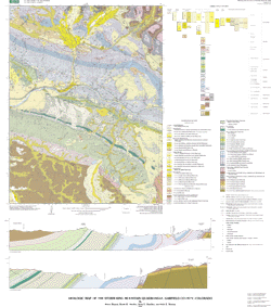
GEOLOGIC MAP OF THE STORM KING MOUNTAIN QUADRANGLE, GARFIELD COUNTY, COLORADO
By Bruce Bryant, Ralph R. Shroba, Anne
E. Harding, and Kyle E. Murray
Version 1.0
The text of this report is presented here in Portable Document Format. The latest version of Adobe Acrobat Reader or similar software is required to view it. If you wish to download the latest version of Acrobat Reader free of charge, click here.
Pamphlet
PDF file (612 KB)
(This version of the report is accessible as defined in Section 508.)
Metadata
file (44 KB)
Readme
text file (4 KB)
Map
PDF file (2.7 MB)
Download the Arc/Info Export Files and Supplemental Information
|
|
|