Skip Links

USGS - science for a changing world

Miscellaneous Investigations Series Map I-1906

Geologic map of the San Luis Hills area, Conejos and Costilla Counties, Colorado

By Ren A. Thompson and Michael N. Machette

Abstract

Thumbnail of and link to Map PDF (5 MB)This report is a digital image of the U.S. Geological Survey Miscellaneous Investigations Series Map I-1906, "Geologic map of the San Luis Hills area, Conejos and Costilla Counties, Colorado," which was published in 1989 by Thompson and Machette, scale 1:50,000 but has been unavailable in a digital version. The map area represents the southwestern portion of the Alamosa 30' × 60' quadrangle, which is currently being remapped by the U.S. Geological Survey. The northern and eastern margins of the San Luis Hills area have been remapped at greater detail and thus small portions of the map area have been updated. The northern margin is shown on U.S. Geological Survey Open-File Report 2005-1392, the northeastern portion is shown on U.S. Geological Survey Open-File Report 2008-1124, and the eastern margin is shown on U.S. Geological Survey Open-File Report 2007-1074. The most significant changes to the 1989 map area are recognition of Lake Alamosa and its deposits (Alamosa Formation), remapping of bedrock in the northeastern San Luis Hills, and redating of volcanic units in the San Luis Hills. Although unpublished, new 40Ar/39Ar ages for volcanic units in the Conejos and Hinsdale Formations add precision to the previous K/Ar-dated rocks, but do not change the basic chronology of the units. The digital version of this map was prepared by Theodore R. Brandt by scanning the original map at 300 pixels per inch, prior to creating the press-quality (96 Mb) and standard (5 Mb) .pdf files.

Version 1.0

Posted September 2008

For additional information contact:
Team Chief Scientist,
USGS Earth Surface Processes
Box 25046, Mail Stop 980
Denver, CO 80225

For sale by
U.S. Geological Survey Information Services,
Box 25286, Federal Center,
Denver, CO 80225;
1-888-ASK-USGS
USGS: Maps on Demand

Part or all of this report is presented in Portable Document Format (PDF); the latest version of Adobe Reader or similar software is required to view it. Download the latest version of Adobe Reader, free of charge.


Suggested citation:

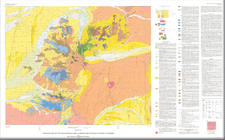
Thompson, R.A., and Machette, M.N., 1989, Geologic map of the San Luis Hills area, Conejos and Costilla Counties, Colorado: U.S. Geological Survey Miscellaneous Investigations Series Map I-1906, 1 sheet, scale 1:50,000.


Accessibility FOIA Privacy Policies and Notices

Take Pride in America home page. FirstGov button U.S. Department of the Interior | U.S. Geological Survey
URL: http://pubsdata.usgs.gov/pubs/mis/I-1906/index.html
Questions or Assistance: Contact USGS
Last modified: Thursday, 01-Dec-2016 12:19:13 EST