
By M.G. Bonilla1
U.S. Geological Survey Open-File Report 75-41
Version 1.1
1975
Prepared in cooperation with National Science Council of Republic of China
and
U.S. Atomic Energy Commission
U.S. DEPARTMENT OF THE INTERIOR
ROGERS C.B. MORTON, Secretary
U.S. GEOLOGICAL SURVEY
V.E. McKelvey, Director
This report is preliminary and has not been reviewed for conformity with U.S. Geological Survey (USGS) editorial standards or with the North American Stratigraphic Code. Any use of trade, firm, or product names is for descriptive purposes only and does not imply endorsement by the U.S. Government.
1 345 Middlefield Road, Menlo Park, CA 94025
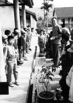
Cracking at north end of stone walk. The narrowing of the gutter can be seen opposite the walk which enters the photo from the right. Photo taken January 17, 1973.
Six faults associated with five large earthquakes produced surface displacements ranging from 1 to 3 m in the period 1906 through 1951. Four of the ruptures occurred in the western coastal plain and foothills, and two occurred in the Longitudinal Valley of eastern Taiwan. Maps are included showing the locations and dimensions of the displacements. The published geological literature probably would not lead one to infer the existence of a fault along most of the 1906 rupture, except for descriptions of the rupture itself. Over most of its length the 1935 rupture on the Chihhu fault is parallel to but more than 0.5 km from nearby faults shown on geologic maps published in 1969 and 1971; only about 1.5 km of its 15 km length coincides with a mapped fault. The coastal plain part of the Tuntzuchio fault which ruptured in 1935 is apparently not revealed by landforms, and only suggested by other data. Part of the 1946 Hsinhua faulting coincides with a fault identified in the subsurface by seismic work but surface indications of the fault are obscure. The 1951 Meilun faulting occurred along a conspicuous pre-1951 scarp and the 1951 Yuli faulting occurred near or in line with pre-1951 scarps.
More than 40 faults which, according to the published literature, have had Pleistocene or later movement are shown on a small-scale map. Most of these faults are in the densely-populated western part of Taiwan. The map and text calls attention to faults that may be active and therefore may be significant in planning important structures.
Equivocal evidence suggestive of fault creep was found on the Yuli fault and the Hsinhua fault. Fault creep was not found at several places examined along the 1906 fault trace.
Tectonic uplift has occurred in Taiwan in the last 10,000 years and application of eustatic sea level curves to published radiocarbon dates shows that the minimum rate of uplift is considerably different in different parts of the island. Incomplete data indicate that the rate is high near Hualien, where an uplift of at least 0.6 m and probably more than 1 m occurred in the 1951 earthquake, and near and south of the 1946 faulting. Sudden uplifts can have serious consequences for installations near the shore. Investigation of this process, study of recently active faults, and continuing study of seismicity are necessary parts of a practical earthquake-hazard reduction program.
The study of active faults and earthquake history provides a basis for anticipating the location and size of future earthquakes and related phenomena such as surface faulting, landslides, and other ground failures. Taiwan has had and will continue to have many strong earthquakes. During the twentieth century more than 20 earthquakes have resulted in human deaths, and during a 45-year period starting in 1906 faulting ruptured the ground surface at six places. Taiwan is thus a place where earthquakes and faulting should be studied to minimize death and destruction, and where knowledge about these geologic processes can be gained for general application throughout the world.
This paper summarizes scattered information, some of which is out of print or unpublished, on recently active faults in Taiwan. In addition to a rather full treatment of historic faulting, the paper calls attention to faults that cut Holocene and Pleistocene deposits and discusses evidence related to fault creep and vertical tectonic movements. Some reinterpretations and inferences are made on the basis of the available information.
The paper is based on a review of the literature done intermittently during the last few years supplemented by a field reconnaissance, a rapid stereoscopic examination of aerial photographs of a few areas, and discussions with many Chinese geologists during a six-week study period in January and February, 1973. The study in Taiwan was done for two purposes: to help initiate geologic studies in the recently formed Chinese Earthquake Research Center and to gather data for a study of worldwide historic surface faulting in which the writer was engaged. The work in Taiwan was supported by the National Science Council of the Republic of China and the United States Geological Survey; the literature study was supported by the United States Atomic Energy Commission and the U.S. Geological Survey.
The work in Taiwan was greatly facilitated by many individuals and organizations. Mr. T.H. Yao of the National Science Council participated in all of the field reconnaissance, recognized the 1906 fault scarp and the Houchiali scarp, served as interpreter, arranged meetings with Chinese scientists, arranged for access to aerial photographs, and used his extensive knowledge of Taiwan geography, geology, and-culture to make the writer's trip pleasant and useful. His participation is also acknowledged at appropriate points in the text. Dr. C. Y. Meng of the Chinese Petroleum Corporation arranged a field trip in western Taiwan, organized meetings with geologists and geophysicists, provided publications, and extended gracious and friendly hospitality. Mr. H. P. Lueng of the Chinese Earthquake Research Center participated in some of the field work and was the first to see the cracks suggestive of fault creep near the 1946 fault. C. C. Biq and T. L. Hsu of the Geological Survey of Taiwan, C. C. Lin and others of the National Taiwan University, and personnel of the Taiwan Power Company, the Tsengwen Reservoir Development Commission, and the Mining Research and Service Organization were generous in supplying publications, information, and other kinds of support. Colleagues in the U.S. Geological Survey in Menlo Park, A. T. F. Chen and C. Y. King translated parts of Chinese reports and L. A. Hodgen drafted nearly all of the illustrations. The writer extends his sincere thanks and appreciation to all of these individuals and organizations.

This report consists of 43 pages with 14 figures and one table. The illustrations (and scan of the two-page table) have a resolution of only 300 dpi to save file size. The report is provided as a PDF file for which you will need Adobe Acrobat Reader to view. You can download a copy of the latest version (4.0 at the time of this publication) by clicking the button above.
CLICK HERE To view the PDF file (of75-41.pdf), (18 MB).
CLICK HERE To view a 600-dpi version of the PDF file (of75-41-600.pdf), (beware: 56.4 MB).
CLICK HERE view the version-history file for this report.
The URL of this page is http://pubs.usgs.gov/of/1975/of75-41/
Date created: October 17, 1999
Last modified: July 8, 2005