Geologic Features of the Sea Bottom Around a
Municipal Sludge Dumpsite near 39½N, 73½W,
Offshore New Jersey and New York: U.S. Geological Survey Open-file
Report 94-152
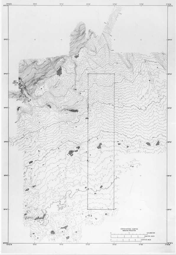
A bathymetric map made from data acquired
aboard the RV Atlantis II in 1989 using a
Sea Beam multibeam echos-sounding system was combined with a
an image of part of the U.S. East Coast
GLORIA mosaic (Robb, 1992;
EEZ-SCAN 87 Scientific Staff, 1991).

Bathymetric contours. Sea-Beam soundings gridded to 125-m
interval and contoured at sea aboard RV Atlantis II, during September,
1989. Depressions are shaded.
In addition, visual observations, photographs, video recordings, and
sediment samples were made during DSRV Alvin dives and a Jason transect
(RV Atlantis II, 1989, RV Betty Chouest, 1991) (Jason is a deep-sea
remotely operated vehicle). Higher resolution sidescan-sonar
observations were made near the central part of the dumpsite area (RV
Betty Chouest, 1991, and RV Oceanus 251, 1992), using a deep-towed 120
kHz system.
Navigation for the data-acquisition cruises relied primarily on Loran-C
supported by fixes from the satellite-based Global Positioning System
(GPS). The fix-accuracy was closer than 100 m and allowed the data sets
to be overlaid precisely on one another.
- To continue, click on:
- Description of the sea floor...
- Discussion...
- Conclusions...
- References Cited...
- Illustrations Summary
- Or, to review, click on:
- Abstract...
- Introduction...
- Data and Methods...
- (Bathymetric map)
- (GLORIA mosaic)
******
[an error occurred while processing this directive]