
by
Susan H. Cannon¹, Philip S. Powers¹, Roger A. Pihl², William P. Rogers²
Open File Report 95-508
¹U.S. Geological Survey, Golden, Colorado
²Colorado Geological Survey, Denver, Colorado
General nature of fire-related sedimentation events
Geologic setting
The post-fire, pre-debris flow setting
The September, 1994 event
Remaining hazards and steps necessary to evaluate their impact
Suggestions for immediate
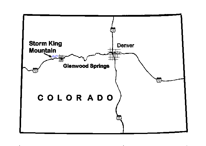
Figure 1. Location map of study area.
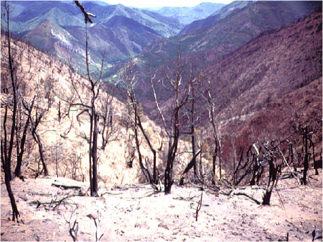
Figure 2. Storm King Mountain after the burn. View is from west to east. Photograph by Pat Rogers, Colorado Geological Survey.
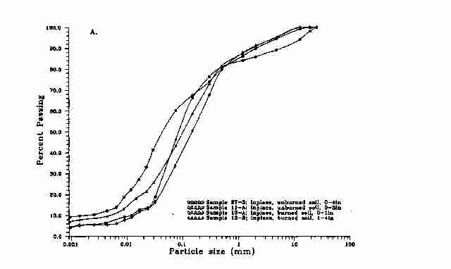
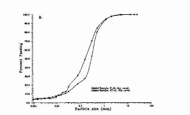
Figure 3. Grain-size distribution curves for: A. inplace burned and unburned soils, B. dry ravel material, and C. slurry.
Figure 4. Area of intense burn showing degree of destruction of vegetation, and loose surficial soil and white ash in foreground. Photograph by Roger Pihl, Colorado Geological Survey.
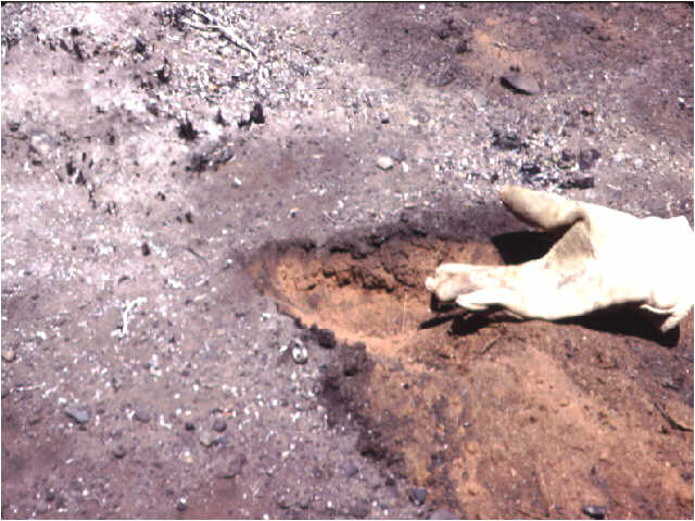
Figure 5. Close up view of loose surficial soil and ash. Loose material is approximately 2 inches thick. Photograph By Roger Pihl, Colorado Geological Survey.
Figure 6. Photograph of loose, fine-grained material transported by dry ravel and wind and deposited in side channels. Deposits, which may be up to 3 feet thick, supplied material for debris flow events in September. Photograph by Roger Pihl, Colorado Geological Survey.
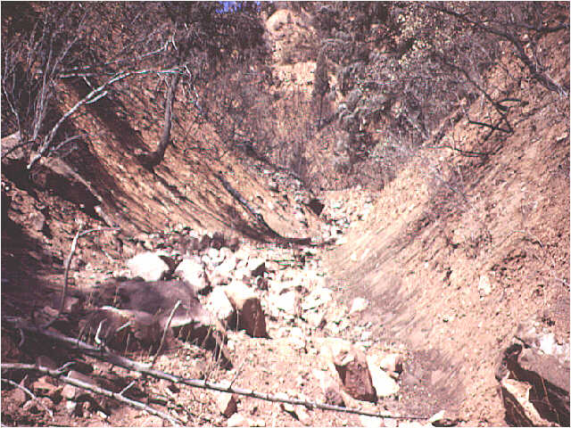
Figure 7. View down channel C before flows. Note small apron of loose dry ravel material deposited along margins of channel and the larger loose boulders; both materials were available for entrainment by the September flow events. Photograph by Roger Pihl, Colorado Geological Survey.
Figure 8. Photograph of dry ravel material deposited as apron on hillside. Photograph by Susan Cannon, U.S. Geological Survey.
Figure 9. Photograph of deposits at drainage B showing fan of material deposited in the Colorado River. Photograph taken on September 2, 1994 by Bob Elderkin, Bureau of Land Management.
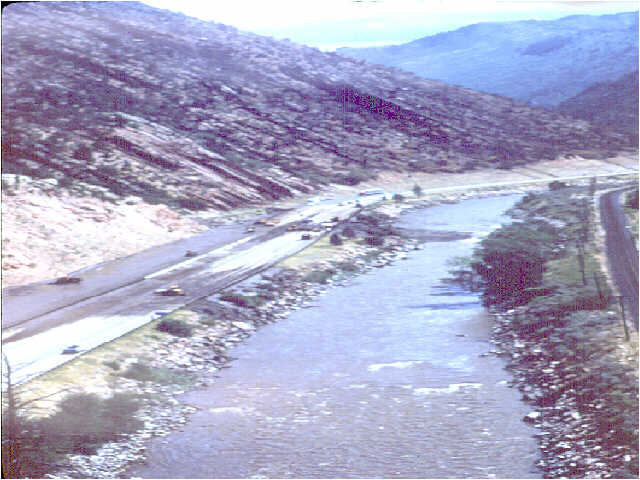
Figure 10. Photograph of material from drainage B showing extent of deposits westward along I-70. Photograph taken on September 2, 1994 by Bob Elderkin, Bureau of Land Management
Figure 11. Photograph showing extent and character of material from drainage B deposited along I-70. Material traveled westward from drainage B to the mouth of drainage B. Note the fluid character of the deposits as they engulf the wheels of the front end loader. Photograph taken on September 2, 1994 by Bob Elderkin, Bureau of Land Management.
Figure 12. Photograph of path and deposits from flow down drainage B. Note deposit of larger-sized material right at mouth of the canyon and the more fluid character of the material that traveled down I-70. Photograph taken on September 2, 1994 by Bob Elderkin, Bureau of Land Management.
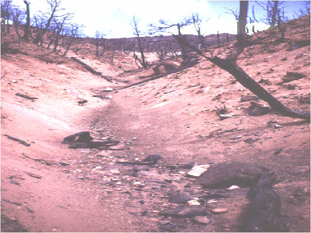
Figure 13. Photograph of deposits from drainage C. Material exited the canyon, traveled down the access road, under the I-70 overpass, and downslope to the Colorado River. Photograph taken on September 2, 1994 by Bob Elderkin, Bureau of Land Management.
Figure 14. Material deposited at base of drainage I. Bridge over Colorado River at South Canyon Creek is visible in distance. Photograph by Roger Pihl, Colorado Geological Survey.
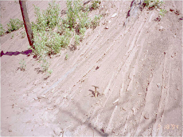
Figure 15. Photograph of rills and gullies on in blanket of loose, dry ravel material deposited on hillside. Rills and gullies also formed in burned surficial soil on hillsides. The average depth of rills on hillsides is estimated to be 1.5 inches, and the process removed approximately 15% of loose surficial material. Photograph by Roger Pihl, Colorado Geological Survey.
Figure 16. Deposits left in the path of debris flow in drainage C. Material was deposited as a thin veneer of mud, and was particularly thin at the margins of deposit. Photograph by Roger Pihl, Colorado Geological Survey.
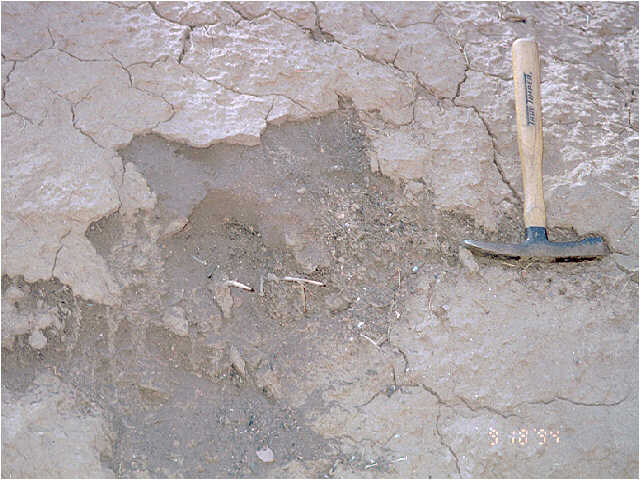
Figure 17. Thin deposit of debris flow overlying very loose, friable ash and burned mineral soil. Undisturbed character of underlying material illustrates the low strength of the material deposited on top. Photograph by Susan Cannon, U.S. Geological Survey.
Figure 18. Material deposited near axis of flow in drainage C. This material was more viscous, indicating a higher strength than the material deposited at the margins of the flow. Photograph by Susan Cannon, U.S. Geological Survey.
Figure 19. Cut in hyperconcentrated flow deposits at mouth of drainage C showing fine-grained, well-sorted material on top grading into gravel-sized, clast-supported material at a depth of approximately one foot. Photograph by Susan Cannon, U.S. Geological Survey.
| AccessibilityFOIAPrivacyPolicies and Notices | |
| |
|