Fracture patterns and their origin in the Upper Devonian Antrim Shale gas reservoir of the Michigan basin: A review
Robert T. Ryder
Open-File Report 96-23
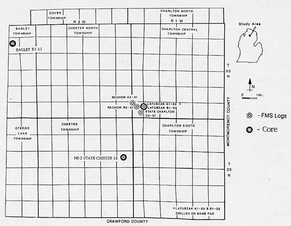
Figure 3 Map of part of Otsego County, Michigan showing location of Antrim Shale gas wells used for fracture studies by Cain (1991), Decker and others (1992), Caramanica (1993), Dellapenna (1991) and Dellapenna and Harrison (1993).
 |
![]()
![]()
Created by the EERT WWW Staff.
[an error occurred while processing this directive]