Fracture patterns and their origin in the Upper Devonian Antrim Shale gas reservoir of the Michigan basin: A review
Robert T. Ryder
Open-File Report 96-23
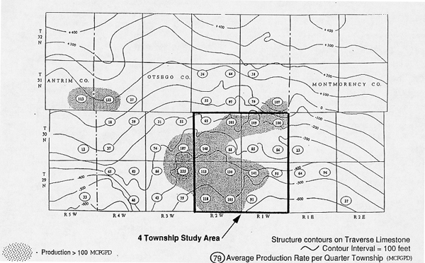
Figure 8 Structure contour map on top of the Traverse Group across a 28-township area of the Antrim Shale gas-producing trend in Otsego County and adjoining Antrim and Montmorency Counties, Michigan. Also shown is the average gas productionr ate (MCFGPD) per quarter township (Decker and others, 1992).
 |
![]()
![]()
Created by the EERT WWW Staff.
[an error occurred while processing this directive]