Coalbed methane potential in the Appalachian states of Pennsylvania,West Virginia, Maryland, Ohio, Virginia, Kentucky, and Tennessee--An overview
Paul C. Lyons
Open-File Report 96-735
Figure 1. Map of part of southwestern Virginia showing coalbed methane fields in the central Appalachian basin. After Nolde (1995) and Cardwell and Avary (1982).
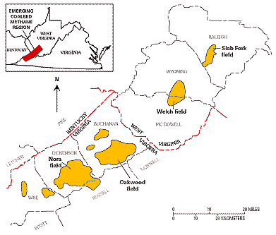
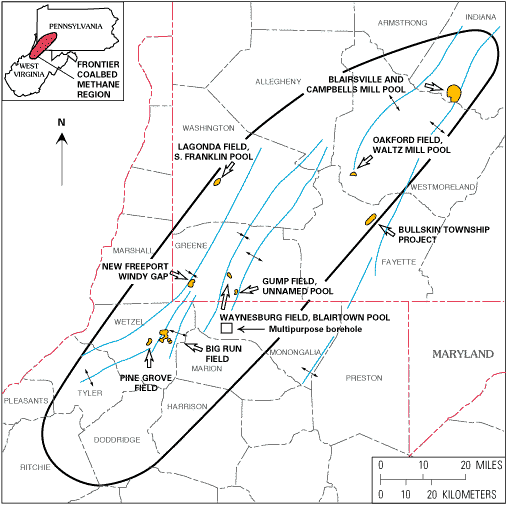
Figure 2. Map of northern West Virginia and southwestern Pennsylvania showing coalbed methane fields and pools in the northern Appalachian basin. After Bruner et al. (1995).
Created by the EERT WWW Staff.
[an error occurred while processing this directive]