 |
|
|
||||
| Open-File Report 97–59 |
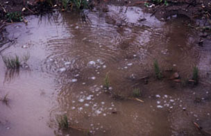
Geology and Structure of the Pine
River, Florida River, Carbon Junction, and Basin Creek Gas Seeps, La Plata
County, Colorado
by James E. Fassett, Steven M. Condon, A. Curtis Huffman, and David Taylor, 1997
Open-File Report 97-59
This report is preliminary and has not been reviewed for conformity with U.S. Geological Survey editorial standards (or with the North America Stratigraphic Code). Any use of trade, product, or firm names is for descriptive purposes only and does not imply endorsement by the U.S. Government.
![]()
INTRODUCTION
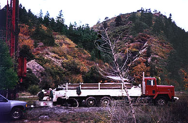
This study was commissioned by a consortium consisting of the Bureau of Land Management, Durango Office; the Colorado Oil and Gas Conservation Commission; La Plata County; and all of the major gas-producing companies operating in La Plata County, Colorado. The gas-seep study project consisted of four parts; 1) detailed surface mapping of Fruitland Formation coal outcrops in the above listed seep areas, 2) detailed measurement of joint and fracture patterns in the seep areas, 3) detailed coal-bed correlation of Fruitland coals in the subsurface adjacent to the seep areas, and 4) studies of deep-seated seismic patterns in those seep areas where seismic data was available. This report is divided into three chapters labeled 1, 2, and 3. Chapter 1 contains the results of the subsurface coal-bed correla-tion study, chapter 2 contains the results of the surface geologic mapping and joint measurement study, and chapter 3, contains the results of the deep-seismic study.
A preliminary draft of this report was submitted to the La Plata County Group in September 1996. All of the members of the La Plata Group were given an opportunity to critically review the draft report and their comments were the basis for revising the first draft to create this final version of a geologic report on the major La Plata County gas seeps located north of the Southern Ute Indian Reservation.
Downloading and viewing the full
report, in PDF format, requires Adobe Acrobat Reader.
If you do not already have Acrobat Reader, you may download
Adobe Acrobat Reader Now. from Adobe Systems Inc.
![]() [2,992KB]
[2,992KB]
(Download the entire report, minus plates, which are listed below)
![]() [12KB]
[12KB]
![]() Title
Page
Title
Page
![]() Contents
Contents
![]() Introduction
Introduction
![]() [301KB]
[301KB]
![]() Subsurface
Correlation of Late Cretaceous Fruitland Formation Coal Beds in the Pine
River, Florida River, Carbon Junction, and Basin Creek Gas-seep Areas,
La Plata County, Colorado, by James
Fassett
Subsurface
Correlation of Late Cretaceous Fruitland Formation Coal Beds in the Pine
River, Florida River, Carbon Junction, and Basin Creek Gas-seep Areas,
La Plata County, Colorado, by James
Fassett
![]() References
Cited
References
Cited
![]() Appendix
1-1 Geophysical-Log Data
Appendix
1-1 Geophysical-Log Data
![]() [2,407KB]
[2,407KB]
![]() Geologic
mapping and fracture studies of the Upper Cretaceous Pictured Cliffs Sandstone
and Fruitland Formation in selected parts of La Plata County, Colorado,
by Steven M. Condon
Geologic
mapping and fracture studies of the Upper Cretaceous Pictured Cliffs Sandstone
and Fruitland Formation in selected parts of La Plata County, Colorado,
by Steven M. Condon
![]() References
Cited
References
Cited
![]() Appendix
2-1 Description of Map Units
Appendix
2-1 Description of Map Units
![]() Appendix
2-2 Rose Diagrams at Fracture Stations
Appendix
2-2 Rose Diagrams at Fracture Stations
![]() [247KB]
[247KB]
![]() Seismic
Structure Studies of the Pine River Gas Seep Area, La Plata County, Colorado,
by A. Curtis Huffman and David J. Taylor
Seismic
Structure Studies of the Pine River Gas Seep Area, La Plata County, Colorado,
by A. Curtis Huffman and David J. Taylor
![]() Acknowledgments
Acknowledgments
![]() References
Cited
References
Cited
Plates
(NOTE: The hardcopy of Plates are oversized documents, requiring dimensions and disk space as indicated. These documents may be viewed in Acrobat Reader or can be saved and made on a plotter in postscript mode. )
![]()
For further information, please contact:
James E. Fassett, Geologist
U.S. Geological Survey
Box 25046, MS 939
Denver, CO 80225
PH: (303) 236-0609
FAX:(303) 236-0459
By electronic mail you may send your comments to jfassett@usgs.gov, or use the form below.
| AccessibilityFOIAPrivacyPolicies and Notices | |
 |
|