
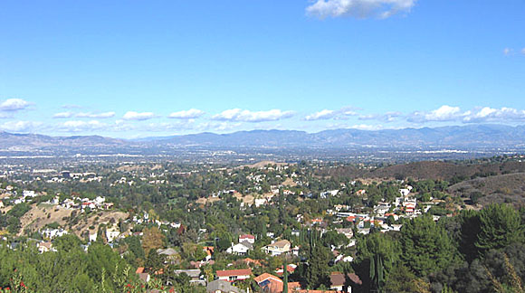
Photograph centered on the city of San Fernando and looking towards the northeast margin of the San Fernando Valley and the San Gabriel Mountains. Named in honor of a Spanish Saint/King, San Fernando was selected for settlement long before the rest of Los Angeles. The City grew out of the ranching activities surrounding Mission de San Fernando Rey. By the early 1800's the settlement had blossomed into a small trading center where farm crops, olives, wine, and thousands of livestock raised by the resident Indians were bought and sold. San Fernando enjoyed a brief gold rush in the 1840s when nuggets were discovered in nearby Placerita Canyon. In 1874, San Fernando became the valley's first organized community, thus earning the title "First City of the Valley".
The city of San Fernando sits atop a structurally complex, sedimentologically diverse, and tectonically evolving late Tertiary-Quaternary basin situated within the Transverse Ranges of southern California. The surrounding San Fernando Valley (SFV) contains the headwaters of the Los Angeles River and its tributaries. Prior to the advent of flood control, the valley floor was composed of active alluvial fans and floodplains. Seasonal streams emanating from Pacoima and Big Tujunga Canyons drain the complex western San Gabriel Mountains and deposit coarse, highly permeable alluvium that contains generally high-quality ground water. The more shallow western part derives mainly from Tertiary and pre-Tertiary sedimentary rocks, and is underlain by less permeable, fine-grained deposits containing persistent shallow ground water and poorer water quality. Home of the 1971 San Fernando and the 1994 Northridge earthquakes, the SFV experienced near-record levels of strong ground motion in 1994 that caused widespread damage from strong shaking and ground failure.
A new map of late Quaternary deposits of the San Fernando area shows that the SFV is a structural trough that has been filled from the sides, with the major source of sediment being large drainages in the San Gabriel Mountains. Deposition on the major alluvial fan of Tujunga Wash and Pacoima Wash, which issues from the San Gabriel Mountains, and on smaller fans, has been influenced by ongoing compressional tectonics in the valley. Late Pleistocene deposits have been cut by active faults and warped over growing folds. Holocene alluvial fans are locally ponded behind active uplifts. The resulting complex pattern of deposits has a major effect on liquefaction hazards. Young sandy sediments generally are highly susceptible to liquefaction where they are saturated, but the distribution of young deposits, their grain size characteristics, and the level of ground water all are complexly dependent on the tectonics of the valley.
The San Fernando area lies on the southern slopes of the San Gabriel Mountains. The basement rocks here include high-grade metamorphic rocks of Precambrian age. The mountains are largely composed of crystalline basement that includes the Pelona Scist of probable Mesozoic age that has been overthrust by Precambrian gneisses; the gneisses were subsequently intruded by Mesozoic plutons prior to overthrusting along the latest Cretaceous Vincent thrust. Gneisses of somewhat variable composition and possibly varying ages are found in four terranes, but not all are in contact with Pelona Schist. Large tracts of Precambrian (1.2 billion years old) andesine anorthosite are intrusive into 1.7 billion year-old Mendenhall gneiss, and are found in the western part of the San Gabriels. Mixed with these are younger marble, limestone, and schist of possible Paleozoic age found in association with plutons along the southern margin of the range. The older rocks are intruded by diorite, quartz diorite, and granodiorite of Jurassic age. Also present are siliceous sedimentary rocks of Jurassic age.
A thick section of Tertiary sedimentary and volcanic rocks overlie these units. The sediments located south of the San Gabriel Fault are totally different in character from those on the northern range flank, and mostly resemble the western Transverse Ranges due to their deposition in the southeastern Ventura basin; approximately 3,000 m of these sediments are exposed north and west of the city of San Fernando in the Tujunga syncline. Some of the Tertiary rocks are Paleocene and Eocene in age, but the bulk of these rocks are Oligocene and Miocene in age. The Vasquez and Sespe Formations of basal basaltic volcanic and sandstone are Oligocene and lower Miocene in age. These are overlain by clastic rocks of Tick Canyon and Mint Canyon Formations of middle to late Miocene age. Above these rocks are the Castaic, Modelo, and Santa Margarita Formations of fossiliferous marine shale, sandstone, and conglomerate. Pliocene units include the Towsley Formation and overlying Pico Formation shale and sandstone, plus the non-marine Saugus Formation gravel and sandstone. Younger Pleistocene and Holocene unconsolidated rocks and sediments overlie the entire sequence.
The San Gabriel Mountains are bounded on the north by the San Andreas Fault, and to the south by the east-west-trending left-lateral faults that separate the range from the SFV, the Los Angeles basin, and the Pomona Valley. The San Gabriel Mountains are actively rising along these east-west frontal faults, and contain the second highest peak in southern California (Mount San Antonio, a.k.a. Mount Baldy), at more than 3300 m in elevation. This range has much of the steepest and most rugged topography found in the Transverse Ranges. In spite of their great height, gravity and seismic data suggest strongly the lack of a root beneath these mountains, which are thus out of isostatic adjustment.
The San Andreas fault that bounds the northwestern San Gabriel Mountains and passes through the northeastern part of the range is active, and was ruptured by the last large earthquake on the San Andreas in southern California, in 1857. The fault trace is occupied by geomorphic features characterizing an active fault, including sag ponds and fault-subsequent valleys carved out of rock crushed within the wide fault zone. Remnants of scarps formed in the 1857 event are still visible in Wrightwood. The San Andreas Fault near Cajon Pass forms the boundary between the San Gabriel Mountains to the west, and the San Bernardino Mountains to the east, separating San Gabriel basement on the south from Mojave basement on the north.
The east west-trending transverse fault system bounding the southern margin of the range is, like the San Andreas fault, active; one of these faults caused the 1971 San Fernando earthquake (magnitude 6+) that caused 2 m of uplift and 2 m of left-lateral translation in the western part of the San Gabriel Mountains. All members of the frontal fault system are pactive or potentially active. Young scarps created by activity on the Cucumonga Fault have been mapped by Morton and others in Day Canyon northwest of San Bernardino. Notable faults within the range include the Punchbowl Fault that parallels the San Andreas in the northern part of the range; the San Gabriel Fault, active from 10 to 5 million years ago, and considered to be the predecessor of the San Andreas; and the Fenner Canyon fault system (active from 15 to 11 mya), now dismembered and considerably offset from its extensions, the San Francisquito fault in the Castaic Block, and the Clemens Well Fault northeast of the Salton Sea. The Fenner Canyon fault system is thought by many workers to be the San Andreas predecessor prior to activity on the San Gabriel Fault.
Files available for downloading:
Download the ReadMe sanfer.txt file as an unformatted documentation file describing content and formats of this publication (19 kb).
Download the ReadMe sanfer.ps file as a PostScript file (880 kb).
Download sanfer.tar.gz containing all the geologic database layers and supporting materials in ARC/INFO 7.x ASCII EXPORT format of the documentation files listed below packaged in a single UNIX tar file, compressed with gzip (14 MB download, 59 MB uncompressed).
Download individual database layers in ARC/INFO 7.x ASCII EXPORT format, each layer compressed with gzip:
Geology - sf-geol.e00.gz containing data on faults, contacts, and geologic units (272 kb download, 1.1 MB uncompressed).
Structure - sf-strc.e00.gz containing data on attitudes and fold axes (24 kb download, 216 kb uncompressed).
Wells - sf-wells.e00.gz containing data on exploratory oil wells (4 kb download, 20 kb uncompressed).
Composite base map - sf-topo.e00.gz containing the composite quadrangle base map layer in vector format (13.2 MB download, 56.6 MB uncompressed).
For questions about the scientific content of this report, contact John Tinsley
Download a free copy of Adobe Reader
This report is available via print on demand.
USGS Information Services
Box 25286 Federal Center
Denver, CO 80225
Telephone: 1-888-ASK-USGS
E-mail: infoservices@usgs.gov
| Help
| PDF help |
| Publications main page
| Western Open-file reports for 1997 |
| Department of the Interior
| U.S. Geological Survey |
| Geologic Division
| Western Earth Surface Processes Team |
| Western Region GIS Home Page |
| Privacy Statement
| Disclaimer
| Accessibility |
The URL for this page is:
https://pubs.usgs.gov/of/1997/of97-163
Please send comments and suggestions, or report problems, to:
Michael Diggles
Updated: September 12, 2007 (bwr)