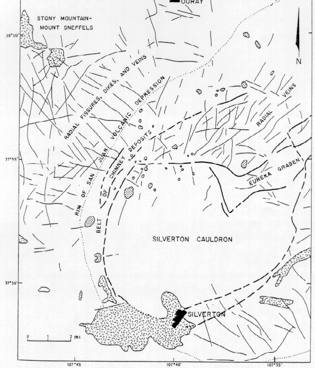
Surface water quality studies in the Animas River drainage basin above Silverton were undertaken beginning in 1991 under the auspices of the CDPHE (J.R. Owen, written commun., 1997). Many streams in the region upstream from Silverton are acidic although the pH is quite variable and zinc is derived from multiple sources within the basin. The iron and aluminum concentrations in these acidic waters is great enough to exceed the solubility product of the various iron and aluminum hydroxides (or aluminum hydroxysulfates, W.G. Wright, written commun., 1997). Precipitation of the iron hydroxide occurs when the pH of the waters is greater than 3.5 and precipitation of aluminum hydroxides occurs when the pH of the waters is greater than 5.5 (Broshears and others, 1996). The rocks in many streams are coated with aluminum- and iron-hydroxides and many of these stream reaches do not support aquatic life (J.R. Owen, written commun., 1997).
Previous reconnaissance exploration stream-sediment geochemical sampling of the watershed had been done in the mid-1970's under the National Uranium Resource Evaluation (NURE) program (Shannon, 1980 Warren and others, 1981). These data were used to evaluate the sources of metals in the small tributary drainage basin (areas of 2-10 km2 or more). These data were of adequate sample density and analytical quality to characterize the geochemical landscape of the Animas River watershed. Geochemical data from small tributary streams from the USGS National Geochemical Data Base (Hoffman and Buttleman, 1994) were used to prepare regional geochemical maps of the Animas River watershed following the procedure outlined by Smith (1994). The details of the computational methods are in appendix I. The preliminary geochemical maps were refined using some of the data presented in this report. Some data points where eliminated from the original data set because the geochemical anomalies that could not be verified. In addition, samples collected along the irrigation ditches were also eliminated because these samples were contaminated by colloidal particles from the Animas River water being used for irrigation. Geochemical maps of four elements, calcium, copper, lead, and zinc, (figs. 5-8, respectively) clearly show how the geology of the Animas River watershed controls the geochemistry of the bed sediments in the Animas River. The map of calcium shows that the volcanic rocks hosting the mineralization in the Silverton area are calcium poor, indicating a lack of carbonate present in the basin. Carbonate species buffer the acid generated by weathering of pyrite in hydrothermally altered zones, mineral deposits, and waste rock piles exposed in the headwaters of the basin. In contrast, streams draining the area underlain by Paleozoic sedimentary rocks (fig. 3) have high calcium concentrations and substantial buffering capability as evidenced by the water chemistry below Cascade Creek as discussed below.
Maps of copper, lead, and zinc show high elemental concentrations in stream sediments collected from the Animas River watershed upstream from Silverton. These maps display the geochemical baseline when the samples were collected in the mid-1970s. The value that geochemists refer to as the crustal abundance value (CAV Fortescue, 1992) in stream sediments is shown in gray on these three maps. Metal concentrations exceed 20 times crustal abundance values in stream sediments above Silverton. Thus, these maps include any effect that mining might have had on the stream reaches within the mining districts. These maps do not give an indication of the premining background levels of metals in the bed-sediments prior to mining in the vicinity of Silverton.