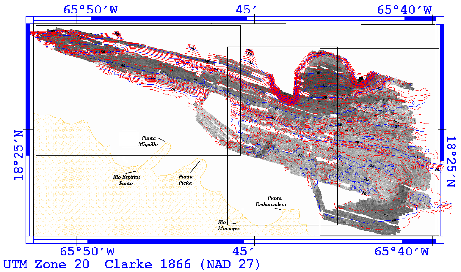
Figure 5a. - Sidescan sonar imagery showing bathymetric contour lines at a 2m contour interval. The 20, 30, 40, 50, 60, 70, 80, and 90m contours are in blue. Clicking within one of the three boxes shown will give a higher resolution image of that section of the mosaic.
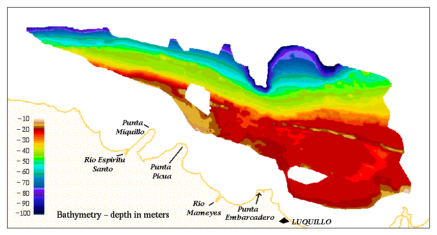
Figure 5b. - Color coded bathymetry of the study area - 2m contour interval.
[an error occurred while processing this directive]