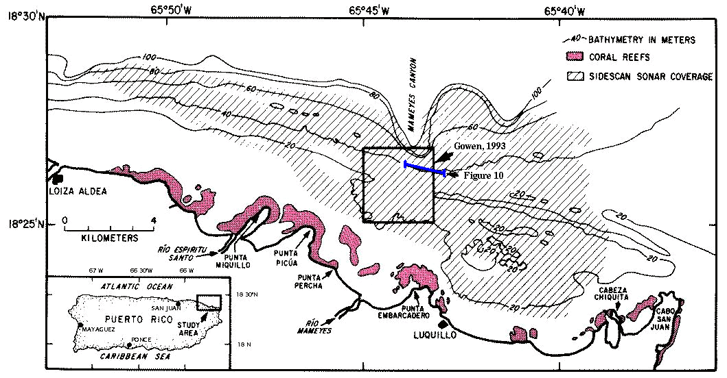
Figure 1. - Map of the insular shelf study area off Luquillo, Puerto Rico, showing the locations of the sidescan sonar imagery coverage, a representative seismic-reflection profile (Fig.10), and the area used for the detailed analysis by Gowen and others (1993).
[an error occurred while processing this directive]