Massachusetts Bay Disposal Site Maps Location
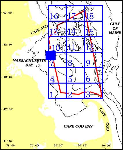
[an error occurred while processing this directive]This location map shows the areal extent of the maps of Massachusetts Bay Disposal Site region (indicated by the blue square). The disposal site itself is a circle, 2 nautical miles (nm) in diameter, that lies within the blue square just west of the Stellwagen Bank National Marine Sanctuary. The red line is the Stellwagen Bank NMS boundary, and the numbered boxes represent individual quadrangles that have been mapped as part of the Stellwagen Bank NMS Mapping Project. The disposal site region mapped here covers an area of 3.7 x 3.8 nm, and extends from 42° 23' 35", 70° 37' 30" (lower left corner) to 42° 27' 14", 70° 31' 59" (top right corner).