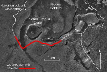
Figure 2. Aerial view showing the summit COSPEC traverse path at Kilauea Caldera. The most notable sources of SO2 in the summit region are fumaroles in and near Halema`uma`u Crater, and solfataras within the caldera. During prevailing trade-wind conditions, the plume is blown across Crater Rim Drive and thus can be measured by driving underneath with a vehicle-mounted COSPEC (Map adapted from Hazlett, 1993).