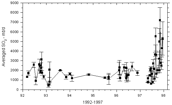
Figure 4. Averaged SO2 emissions from Kilauea's east rift zone as measured by vehicle-based COSPEC along Chain of Craters Road, 1992 through 1997. The black vertical bars represent the standard deviation of all traverses on a single day. These measurements have typically provided the best integrated estimate of Kilauea's ERZ SO2 release.